Unveiling ancient worlds through cutting-edge technology, Visualskies helped bring history to life on National Geographic’s Lost Cities with Albert Lin.
Some projects push the boundaries of what’s possible. Lost Cities with Albert Lin is one of them. National Geographic’s extraordinary series, now available on Disney+ UK, takes viewers on a thrilling journey to uncover ancient civilisations hidden beneath our feet. This ambitious production brought together cutting-edge technology, expert fieldwork, and a passionate team determined to bring history to life – Visualskies was honoured to be part of that journey.
A World of Discovery
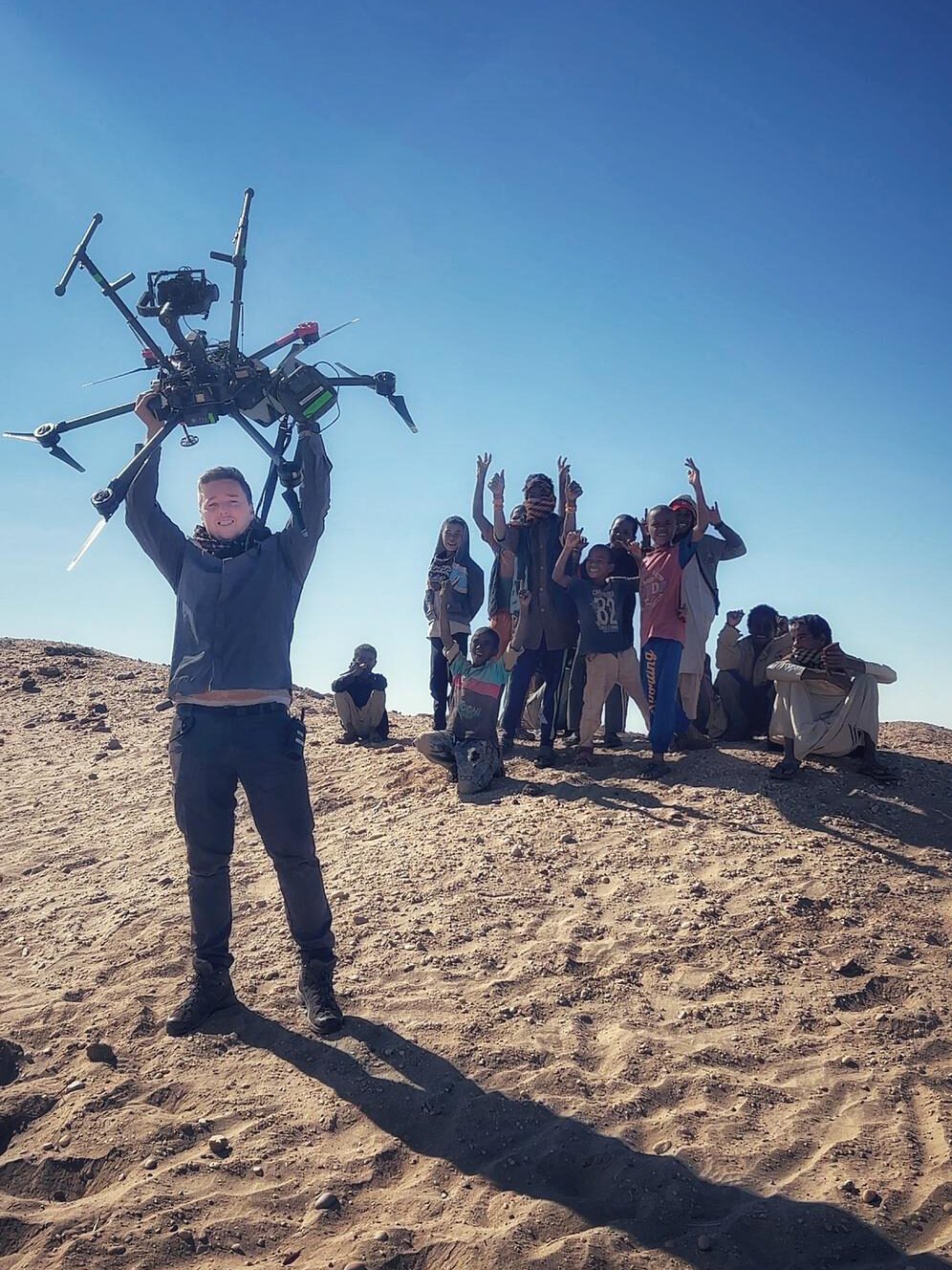
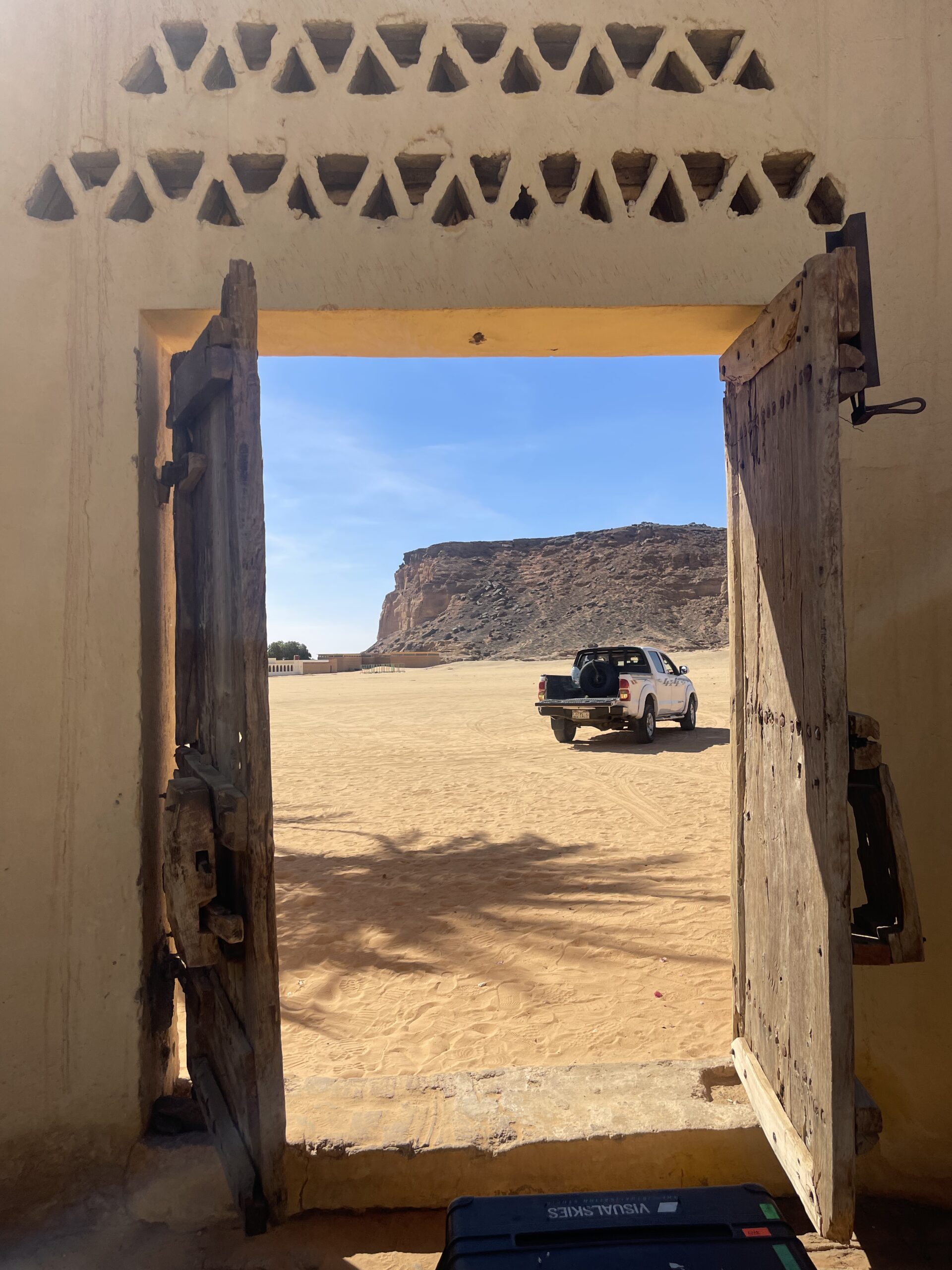
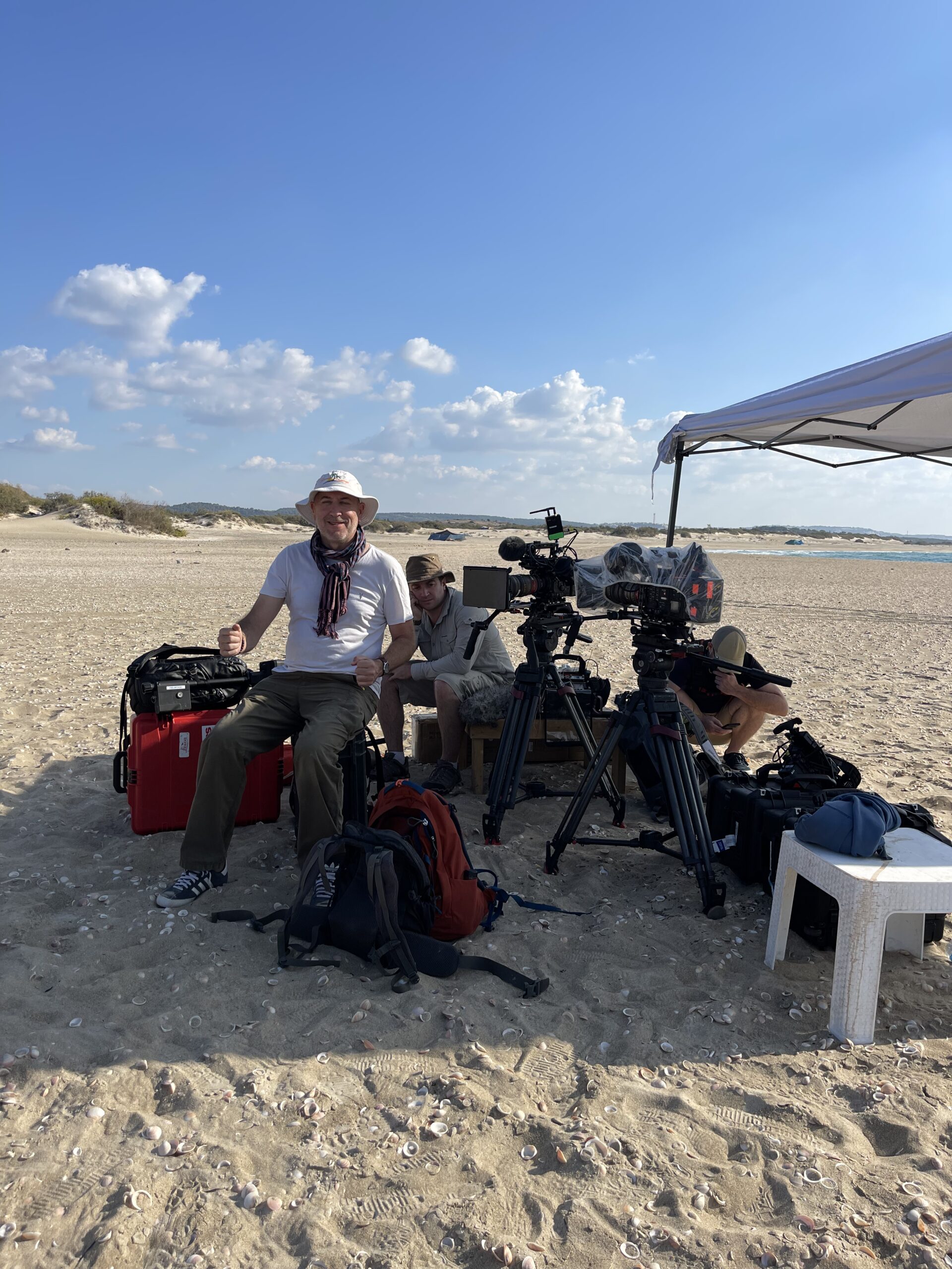
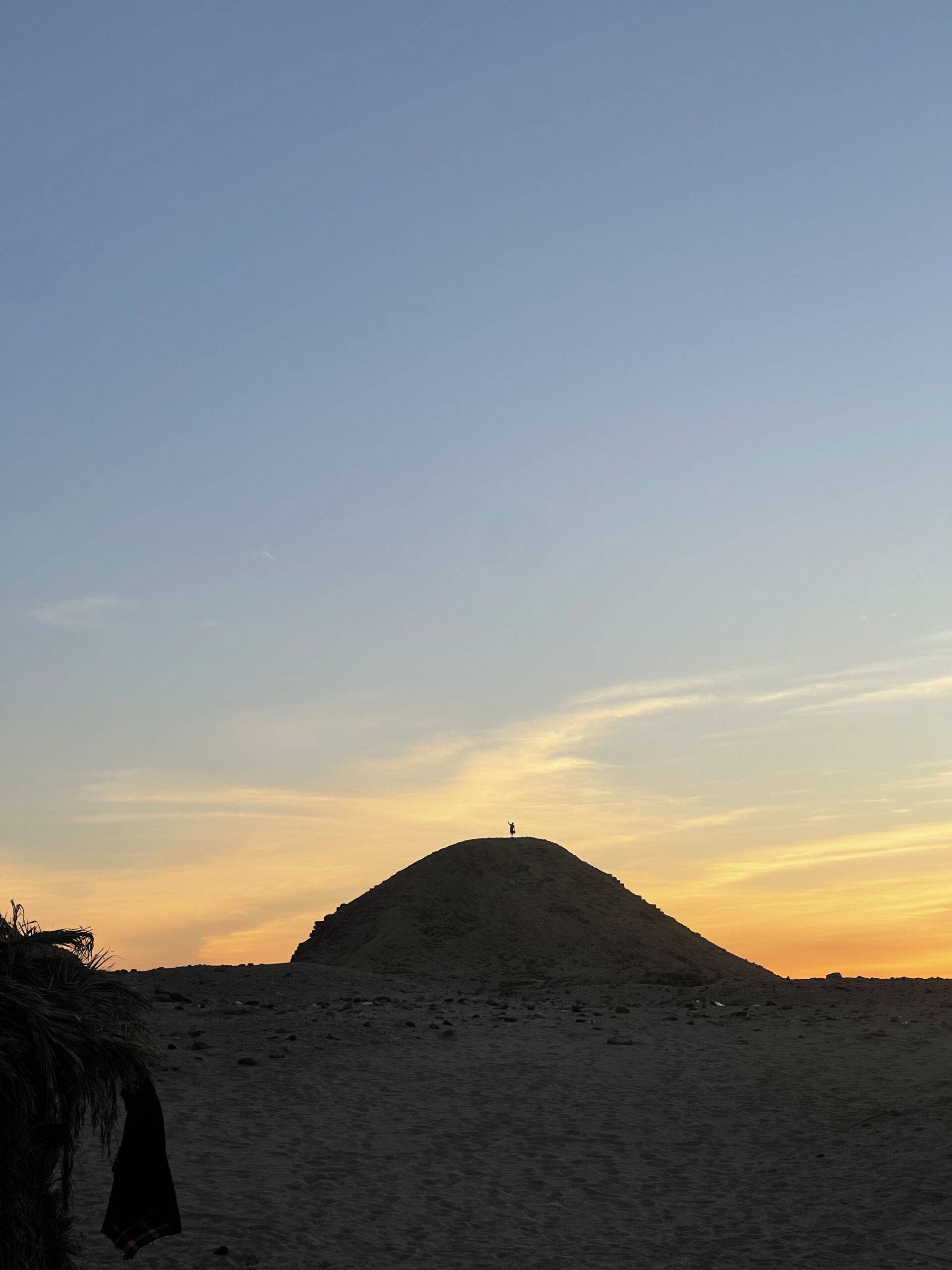
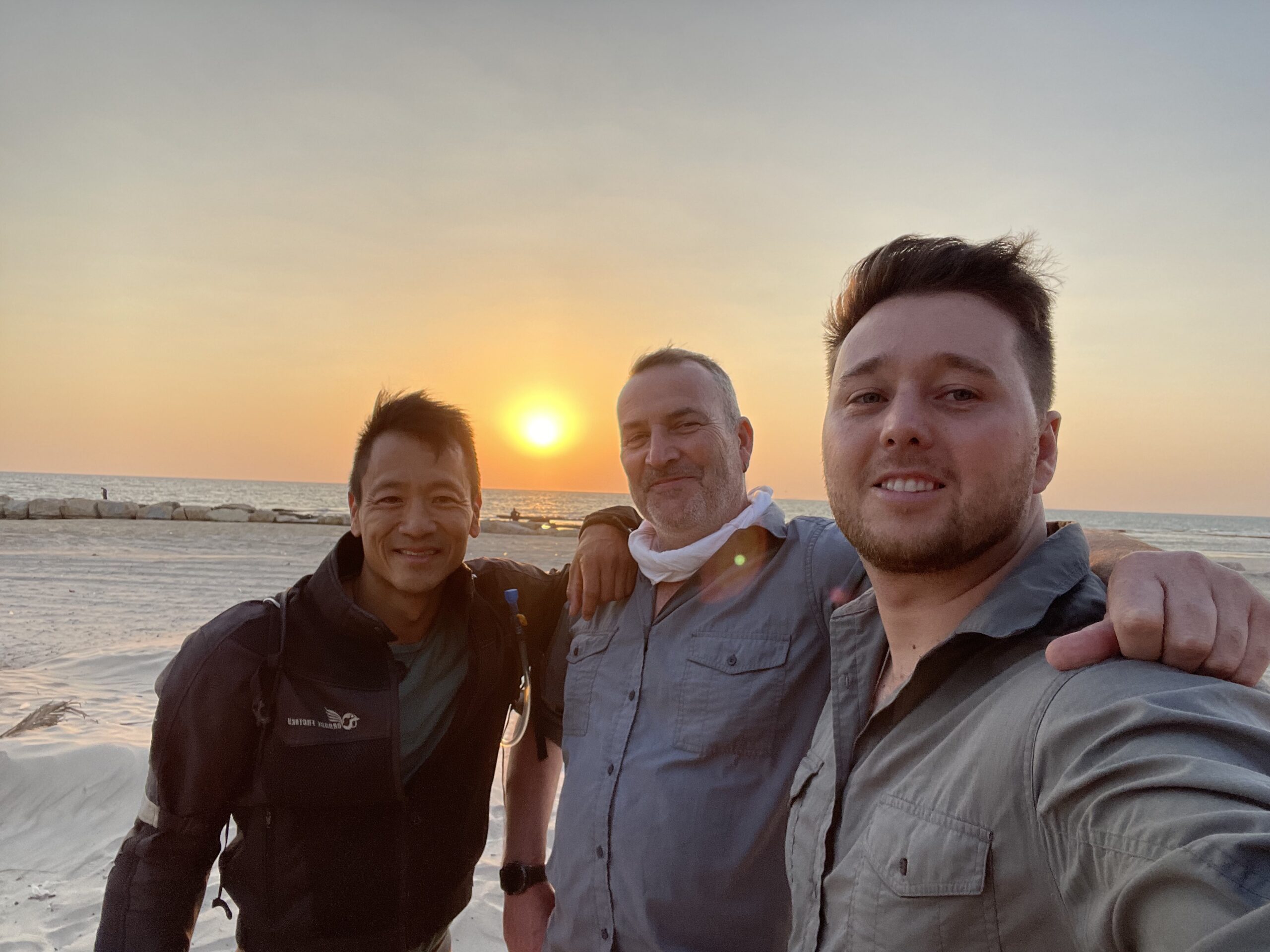
Season 2 of Lost Cities with Albert Lin took the team across the globe, from the arid deserts of Sudan to the dense jungles of Mexico. Each location told a unique story – some whispered through crumbling ruins, others hidden beneath centuries of earth and vegetation. Bringing these stories to the surface was no small task, but with a combination of advanced 3D scanning, LiDAR, and aerial photogrammetry, we helped turn lost worlds into vivid, detailed reconstructions.
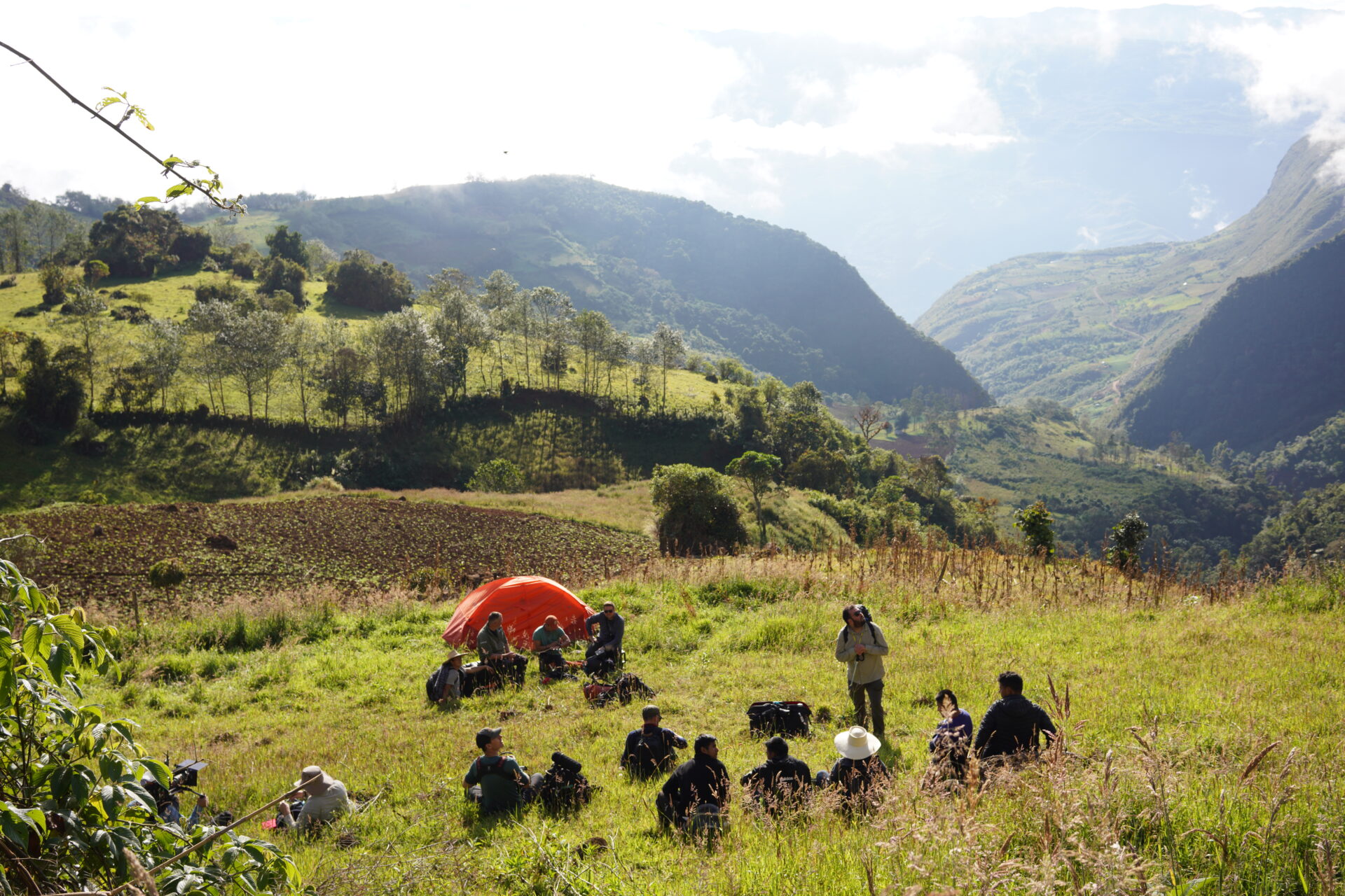
From the towering fortresses of Israel to the sacred ruins of Peru, from the trade routes of Oman to Scotland’s mysterious hillforts, our team worked relentlessly to document and preserve these sites. Every environment posed its own challenges, from blistering heat to near-impenetrable terrain, but our drive to uncover history kept us moving forward.
The Tools That Made It Possible
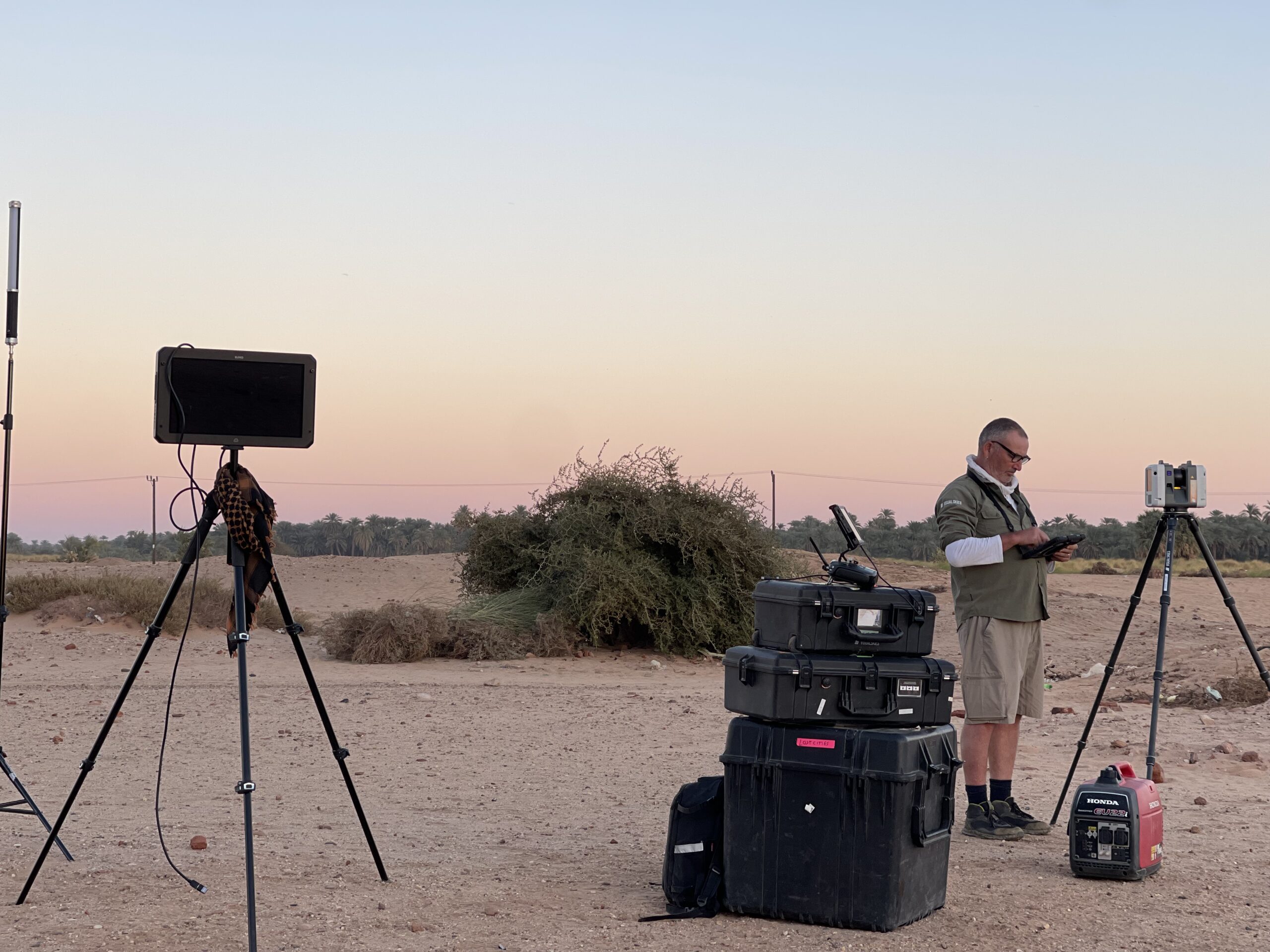
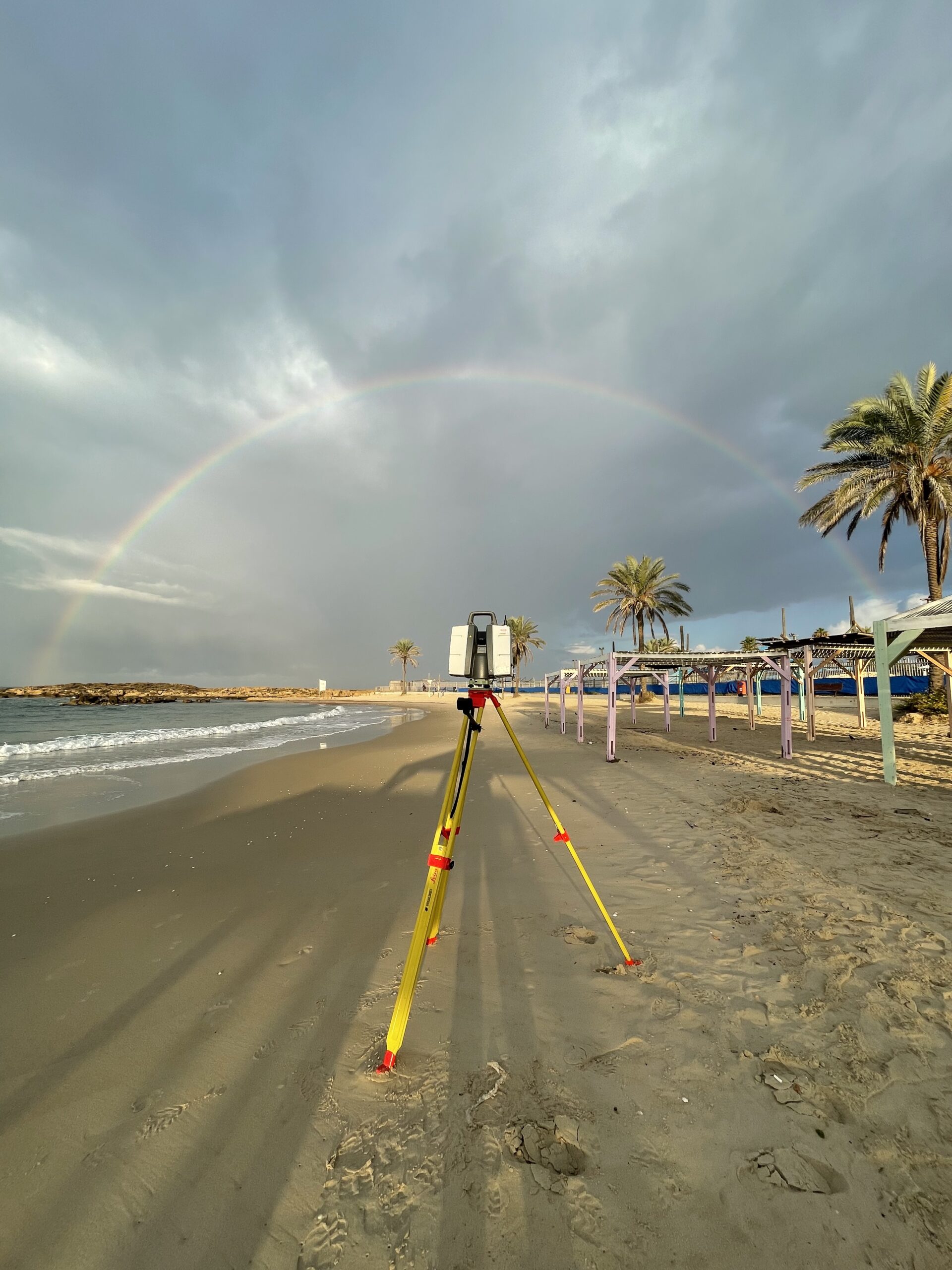
Bringing the past to life requires the right tools. Our work on Lost Cities was made possible through a combination of the latest in drone technology, high-precision LiDAR scanning, and state-of-the-art photogrammetry. DJI drones proved invaluable, particularly the M300, which allowed us to scan vast areas with unparalleled accuracy. Equipped with Sony full-frame cameras, these UAVs captured stunningly crisp images, ensuring that every texture and detail was preserved. Meanwhile, Leica’s RTC360 and P50 LiDAR scanners enabled us to penetrate dense foliage and digitally reconstruct sites with millimetre precision.
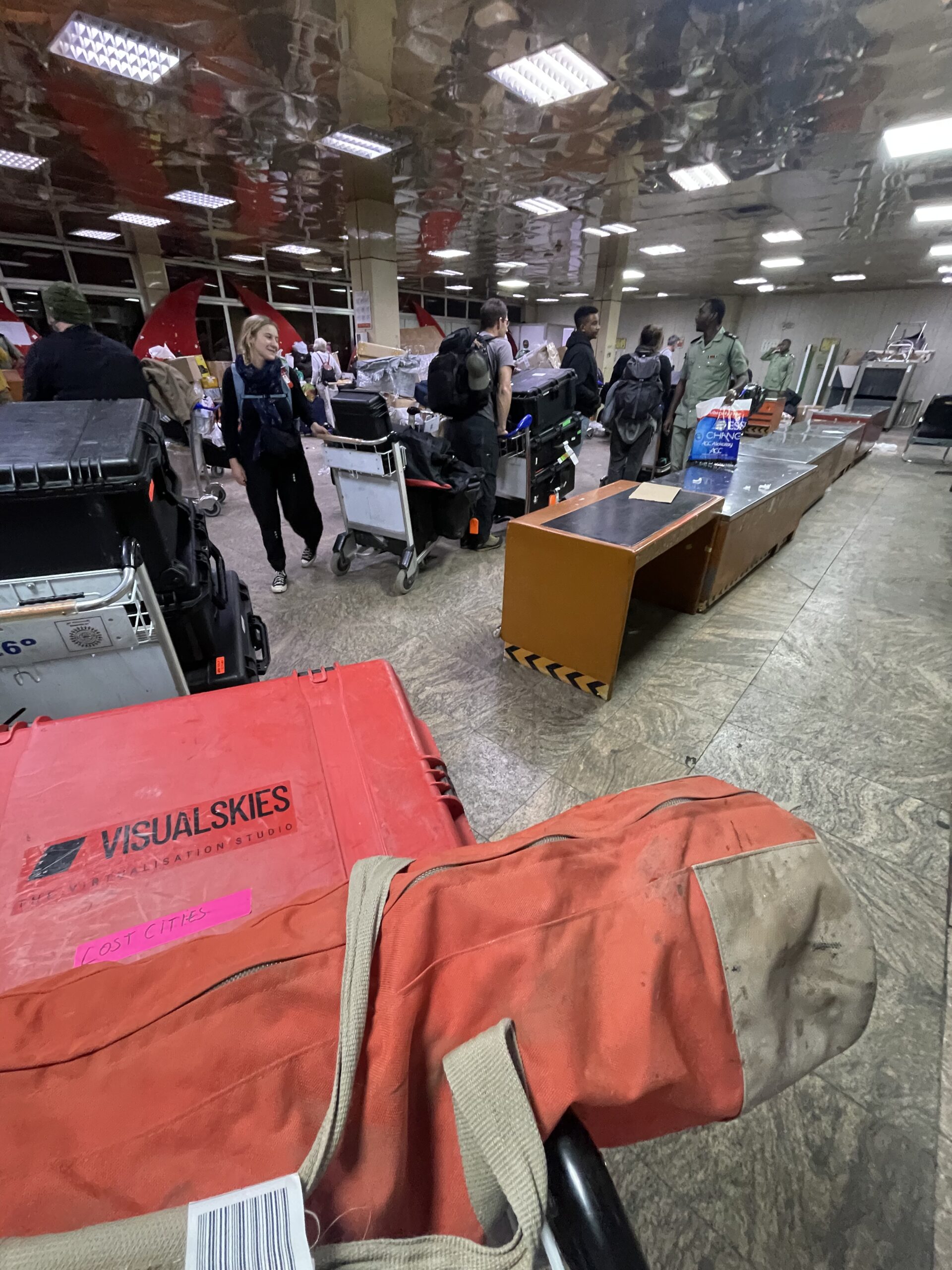
Transporting this delicate technology across challenging landscapes required serious protection. Pelicases and HPRC cases ensured our equipment arrived intact, shielding it from extreme temperatures, humidity, and rough handling. Without this level of protection, capturing and preserving ancient sites would have been far more difficult.
Data in the Field
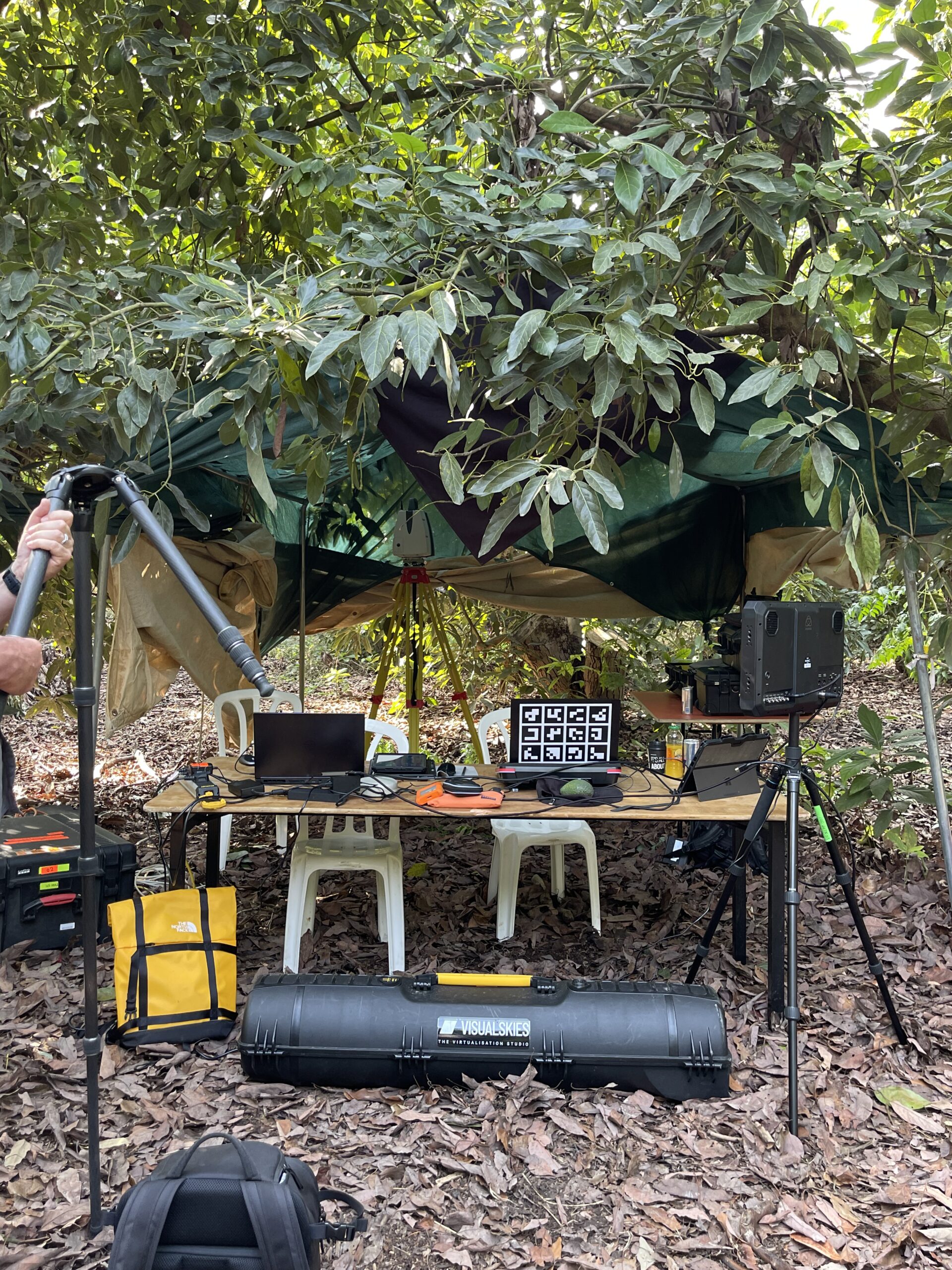
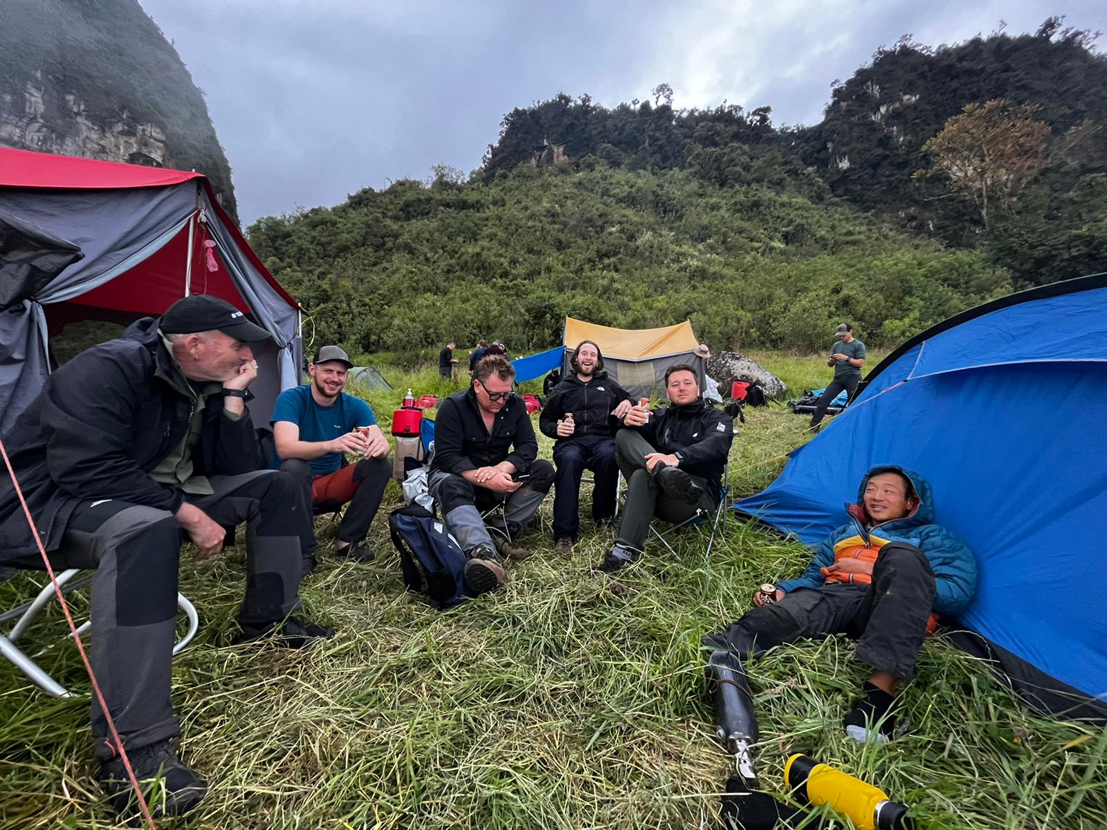
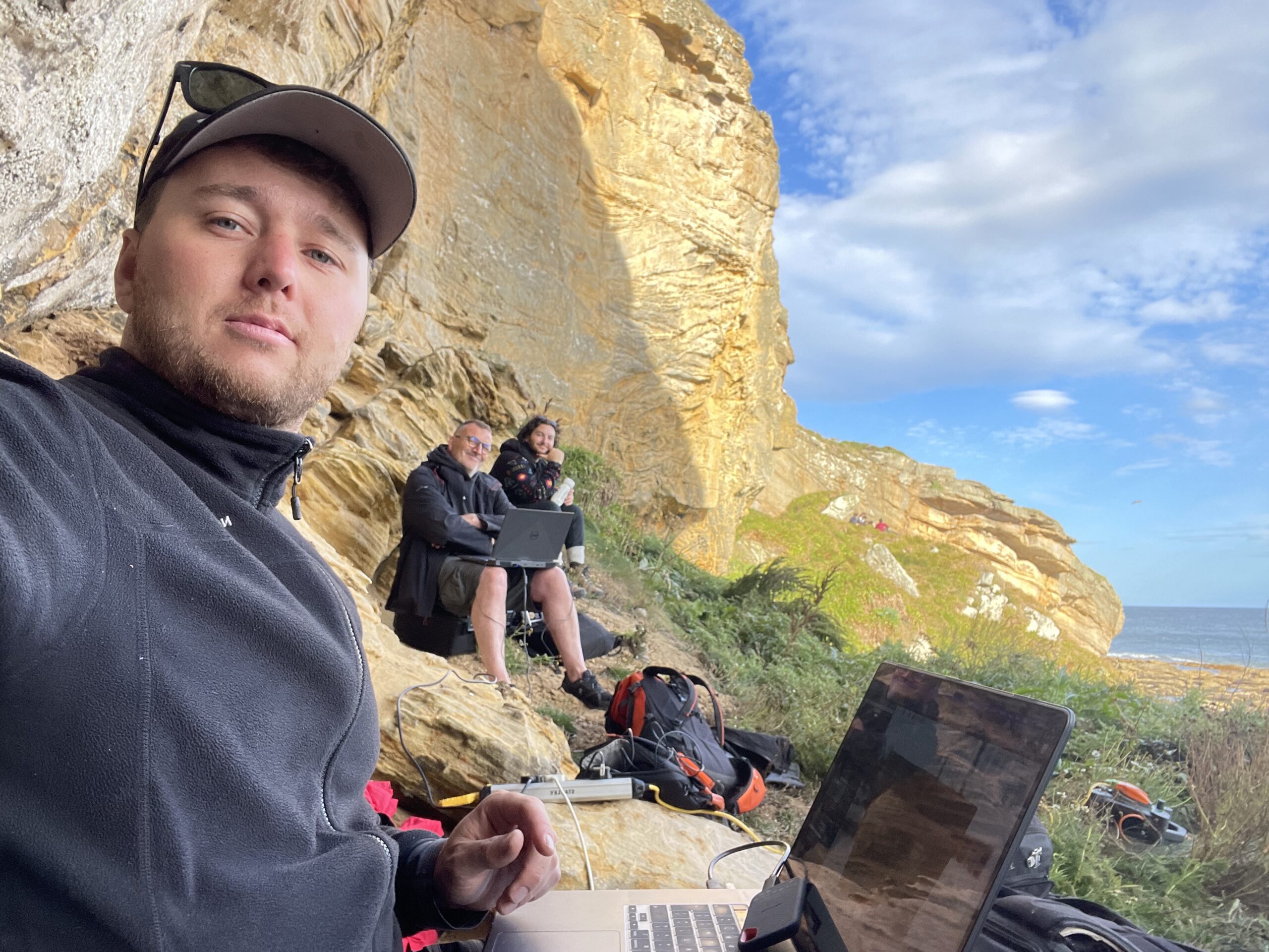
Capturing history is one thing – processing it in the field is another challenge entirely. The team often found themselves setting up makeshift workstations in tents, battling extreme temperatures, humidity, and, in some cases, relentless swarms of mosquitoes. Despite these conditions, on-site data processing was crucial. It allowed us to check scans in real time, make adjustments on the fly, and ensure that no crucial details were missed.
Generating visuals on location was also a key part of the workflow, providing immediate insights for archaeologists and local teams. Seeing a buried structure come to life in front of their eyes was a powerful moment – one that reinforced the impact of our work in bridging the past and the present.
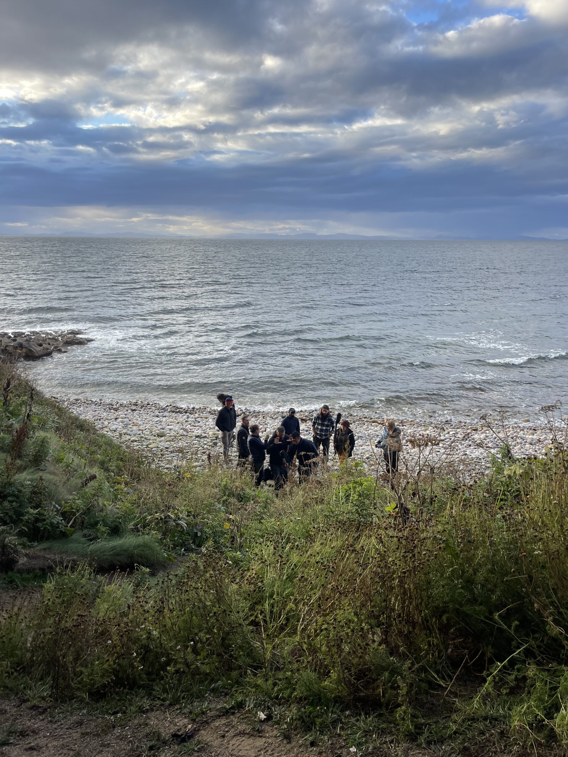
Scotland: The Barbarian Kingdom
Scotland’s rugged highlands presented one of the most physically demanding shoots of the series. Our team relied on aerial scanning to reach inaccessible locations, particularly in capturing the ancient hillforts such as Tap o’Noth. The DJI M300 drone, mounted with the L1 sensor, was flown using UgCS mission planning software, which proved indispensable in overcoming the challenges of steep inclines and unpredictable weather.
UgCS allowed us to pre-program flight paths and autonomously execute them on-site, ensuring a highly efficient and accurate scan. The software enabled us to balance key parameters such as flight speed, distance between grid lines, and overlap, optimising battery use and maximising daylight hours. Its terrain-follow function was particularly valuable, using Google Earth 3D terrain data to maintain a consistent altitude above the rugged landscape. This ensured uniform scan resolution and comprehensive coverage, even over difficult terrain.
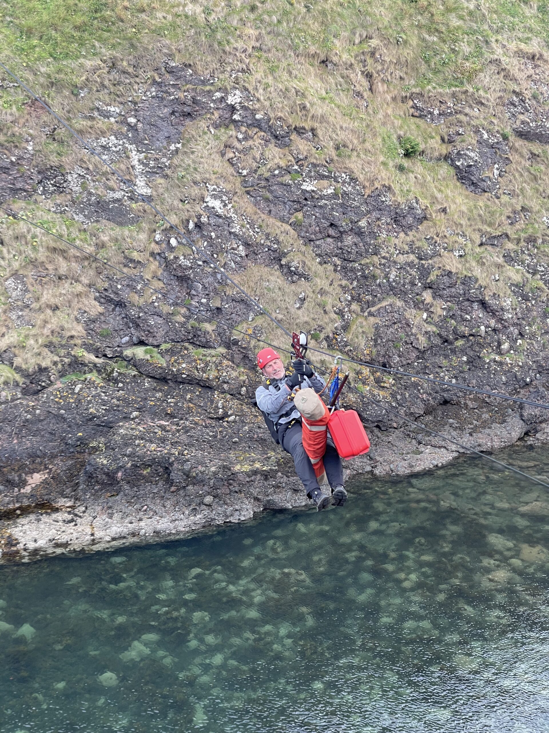
Beyond capturing photogrammetry, the drone also played a crucial role in setting up a zip line, which allowed our operatives and equipment to access otherwise unreachable locations. The zip line was instrumental in transporting gear to the isolated sea stack, enabling our team to complete the scan. Collaboration with the University of Aberdeen further enriched the project, combining our high-resolution 3D scans with their existing research to create a more complete picture of Scotland’s ancient past.
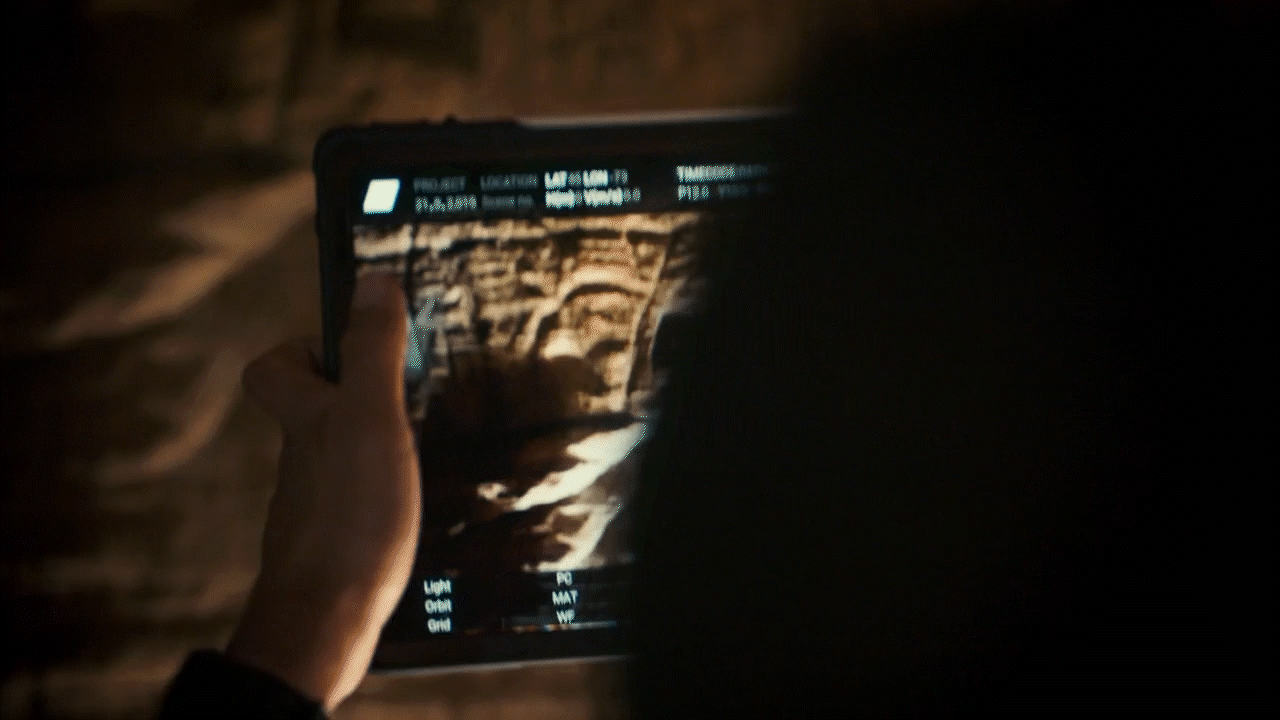
Additionally, our work included scanning intricate Pictish cave carvings, preserving these ancient artworks in high-resolution 3D. By integrating an interactive 3D viewer of the carvings, we provided an immersive experience, allowing researchers and the public to explore these remarkable artefacts in stunning detail from anywhere in the world.
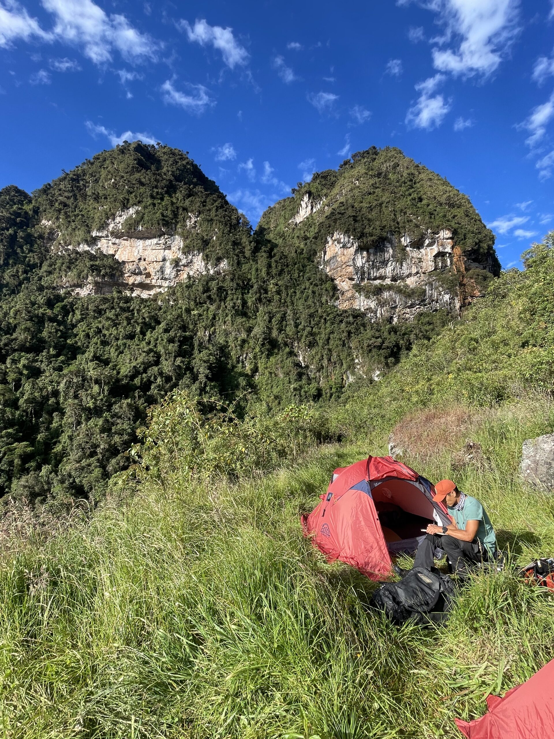
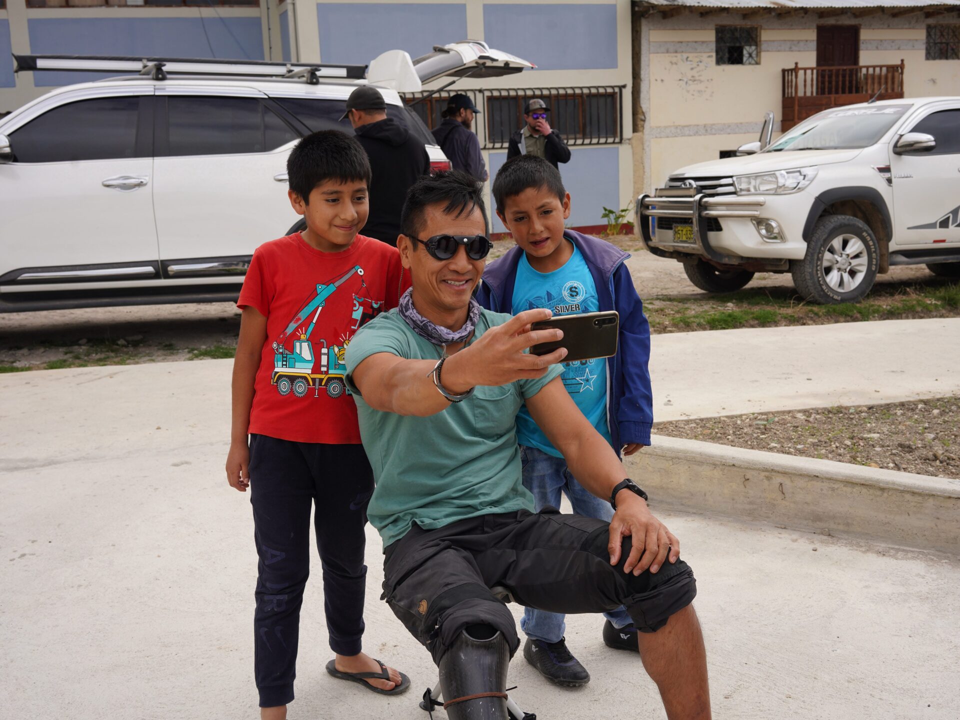
Mexico: Cradle of the Maya
Deep in the jungles of Mexico, we uncovered lost structures hidden beneath centuries of overgrowth. Our Leica LiDAR scanners proved essential, allowing us to digitally strip away vegetation and reveal the stunning architecture beneath. The fusion of aerial and terrestrial scanning provided an unprecedented level of detail, helping to reconstruct the scale and grandeur of this Mesoamerican civilisation.
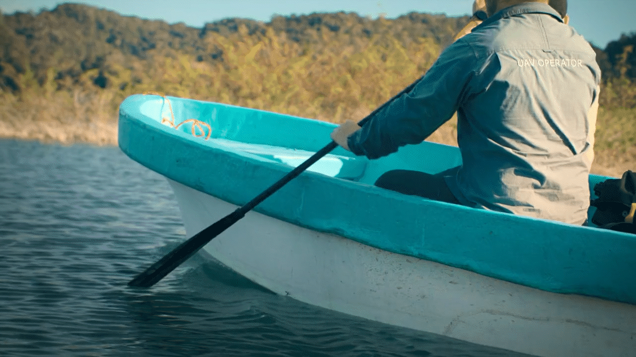
Working in Mexico was an adventure in itself. Each morning, the crew had to row themselves – and cases of equipment – through narrow waterways in the mangroves for nearly two hours before reaching the site. Navigating the labyrinthine swamps in the humid tropical climate was no easy feat, but with the help of local guides, we were able to find the best routes through the dense jungle. The environment was teeming with mosquitoes and even alligators, adding to the daily challenges of the expedition.
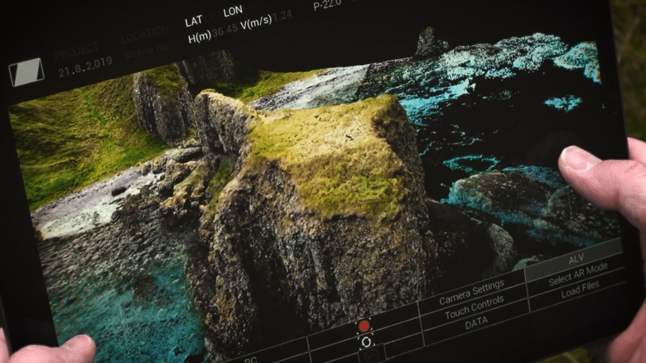
One of the most extraordinary moments came when we successfully located a lost pyramid, hidden for centuries beneath the jungle canopy. This discovery was visualised in the VS Scout app, allowing us to see the structure in the field like never before. The ability to pre-visualise data in real time was instrumental in confirming our findings and ensuring the most efficient use of our scanning technology.
In addition to scanning the pyramid, we captured highly detailed 3D scans of significant artefacts, including a beautifully preserved stela of the renowned Maya ruler Pakal. This interactive 3D viewer allows users to explore the intricate carvings and inscriptions up close, bringing ancient artistry to life in a way that was never before possible. By combining traditional archaeological techniques with cutting-edge digital tools, we provided a new perspective on the artistic and historical significance of these incredible relics.
The Power of VS Scout
A true game-changer in our workflow was the VS Scout app, developed in-house by Visualskies’ own Joseph Steel. This innovative tool revolutionised the way we worked, allowing us to visualise scanned data in real time and seamlessly integrate multiple layers of information – including Ground Penetrating Radar (GPR), thermal imaging, and 3D reconstructions – directly on-site. With VS Scout, we could instantly overlay different datasets, making it easier to visualise data, align aerial and ground-based captures, and refine our scanning process on the fly.
But the impact of VS Scout didn’t stop at technical efficiency – it became a key storytelling device. As we tirelessly collected, integrated, and interpreted vast amounts of 3D data, the app gave Albert Lin an interactive window into these newly uncovered worlds. Using augmented reality (AR), VS Scout enabled us to visualise ancient structures right in the field, guiding our crew deeper into uncharted territories in pursuit of lost civilisations.
Every piece of data visualisation you see in this series was captured, processed, and presented while still in the field – often within mere days. The app’s versatility meant we could present findings in any format, from AR and VR to projection mapping, transforming raw data into immersive, high-impact storytelling tools. By harnessing this cutting-edge technology, we didn’t just scan history – we brought it back to life, peeling away layers of time to reveal secrets hidden beneath the surface.
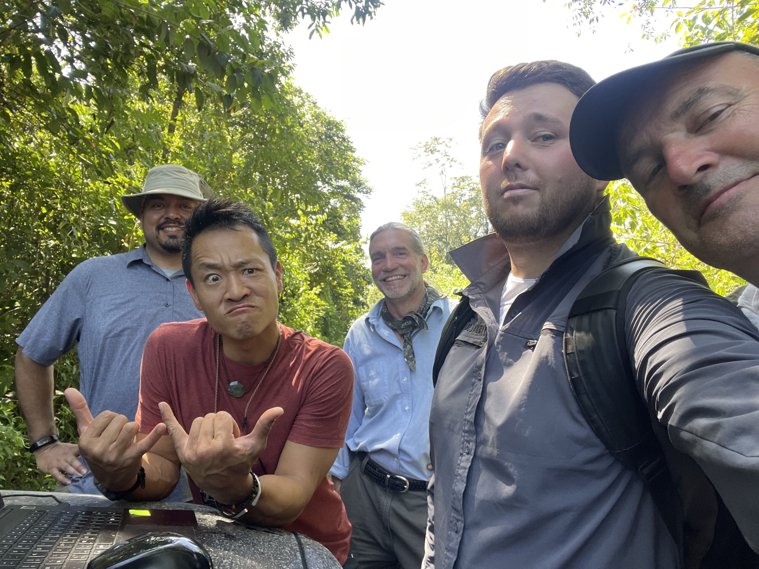
The Team Behind the Scenes
Of course, none of this would have been possible without the dedication of our incredible team. While Ross Dannmayr and Lydia Fauser played key roles in data collection in Scotland, the on-screen efforts of Duncan Lees and Joseph Steel were instrumental in bringing Lost Cities to life. Their adaptability, skill, and enthusiasm ensured that every discovery was captured with precision and care.
A huge thanks goes to Raw TV for their outstanding production work, and of course to Albert Lin, whose vision and passion for uncovering history made this entire adventure possible. His ability to translate complex archaeology into engaging storytelling is truly inspiring.
Looking Back, Moving Forward
At Visualskies, we are immensely proud of our contribution to Lost Cities with Albert Lin. This project pushed us to new heights – both literally and figuratively – challenging us in ways we never imagined. As we continue to explore the possibilities of technology in archaeology, we remain committed to uncovering the past and preserving history for future generations.
Find out more
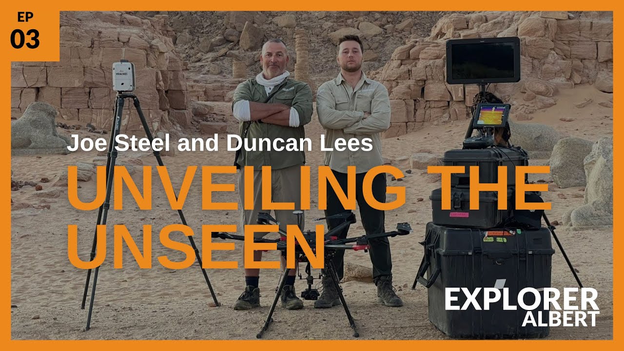
For those curious about the stories behind the series, Dr. Albert Lin hosted a podcast featuring Duncan Lees and Joseph Steel. The episode dives into their adventures on Lost Cities, offering a behind-the-scenes look at their collaborative efforts to uncover ancient civilisations.
Listeners can tune in on Spotify, Apple Podcasts, or YouTube to hear how LiDAR technology and Visualskies’ expertise brought these discoveries to life. From anecdotes about on-site challenges to insights into the groundbreaking technology used, the podcast provides a deeper appreciation of the work that went into this extraordinary series.
 Follow us on Instagram Like our Page on Facebook Subscribe to our YouTube Channel Connect with us on LinkedIn
WHERE TO FIND US?
Visualskies is proud to offer our expert Photogrammetry services for VFX across multiple locations worldwide. Our presence in key cities enables us to provide prompt and efficient service to our clients. You can find us in the following locations.


Mobile Photogrammetry Rigs VFX London
5 Havelock Terrace
Battersea
London
SW8 4AS
United Kingdom