Overview
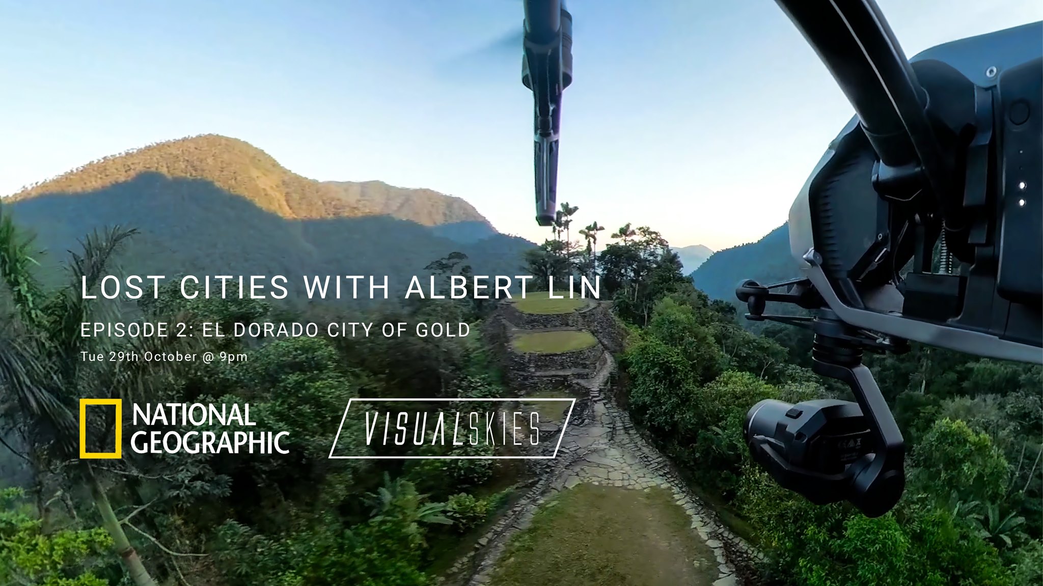
VS Scout in action: Six hundred and fifty years before the Incas built Machu Picchu, another civilization was working on its own cities of gold. As the waves of the Caribbean lapped against the shores of northern Colombia the age of the mysterious Tayrona people had begun. What could be more intriguing to National Geographic, Albert Lin and the team from Visualskies than an ancient abandoned city? Ciudad Perdida (literally ‘Lost City’) disappeared into the jungle around the time of the Spanish Conquest and was only ‘discovered’ again in the 1970s. Hidden deep in the dense rainforest of the Sierra Nevada de Santa Marta mountains in Colombia, Ciudad Perdida was built by the Tayrona people more than 1,000 years ago. Also known locally by its indigenous name of Teyuna, the city consists of a series of around 170 terraces carved into the mountainside, a network of tiled roads and several small circular plazas. The entrance can only be accessed by a climb up some 1,200 stone steps through dense jungle. Teyuna pulsed as the heart of a network of smaller settlements along the ridges and valleys of the highest coastal mountain range in the world; the peaks of the Sierra Nevada loom over 5,700 meters (18,700 feet) above jungles stretching to the sea. In the shadows of these glacier-capped giants, priests, artisans and militia worked to expand a civilization. Modern archaeologists are engaged in a battle to discover the full scope of the enormous network of settlements around Ciudad Perdida, as well as to preserve and protect the historic site against climate, vegetation, neglect, and looting.
Project
Lost Cities With Albert Lin
Client
Blakeway TV Productions
What We Did
3D Surveying and Photography and Video
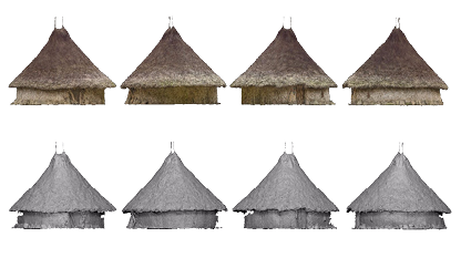
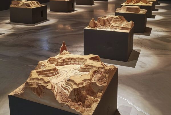
A scanned example of an ancient Kogi hut
The incredible
Location
The usual route into Ciudad Perdida is an arduous hike that takes several days through the dense jungle. As the team had to take huge quantities of filming equipment, including our specialist surveying kit comprising laser scanners, cameras and drones, the Visualskies crew along with Albert and the shoot crew were flown into the site by helicopter; which involved a hair raising ride over the huge mountain range through very thin air. Our first impression of the extant remains of the lost city was, therefore, a spectacular aerial view that underlined just how difficult it was going to be to document the known city and, more importantly, to prospect for as yet undiscovered remains in the vast landscape around Ciudad Perdida. The majority of the Tayrona complex is almost invisible due to the lush tree cover over the whole Sierra Nevada mountain range, so it was going to be almost impossible to document, digitise and visualise the lost remains using solely traditional survey techniques. To allow Albert and the team to find more of the lost city, we utilised both drone and helicopter-mounted 3D scanning technology that could penetrate the vegetation canopy, as well as terrestrial LiDAR, to reveal remains that, to the naked eye, were completely hidden. Visualskies worked assiduously to collect, integrate, visualise and interpret the results of the 3D scanning, enabling Albert to see the incredible new data in our Augmented Reality (AR) App and to take the crew off into uncharted territory on the quest for a new Lost City.
See a breakdown of our work here
The Tools We Deployed
‘Ground Truth’
Terrestrial LiDAR
Utilising the high accuracy of the Leica P50 we were able to capture intricate details with high fidelity – This device also allowed us to combine aerial photogrammetry with ground LiDAR to create a large scale, high accuracy, photo-realistic 3D model of the town of the terraces.


Textured Dataset
Aerial Photogrammetry/ Video
We captured over 5000 images of the site and combined them with the LiDAR data.
We also provided 6k plates for use in the film along side 360 degree video.