LiDAR and 3D Gaussian Splatting Across the AEC Lifecycle
Most AEC projects generate the same data twice — or more. A feasibility team commissions a desktop study. Then a topographic survey. Then a condition report. By the time the marketing suite is being fitted out, someone suggests a 3D visualisation that looks nothing like the actual building because nobody handed over the survey data from year one.
We’ve spent a long time working out how to fix that. The short answer: one continuous digital twin, built at viability and refined through to sale. Here’s what that looks like at each stage — and the projects we’ve done it on.
AEC project lifecycle — Visualskies 3D scanning and Gaussian splatting from viability to marketing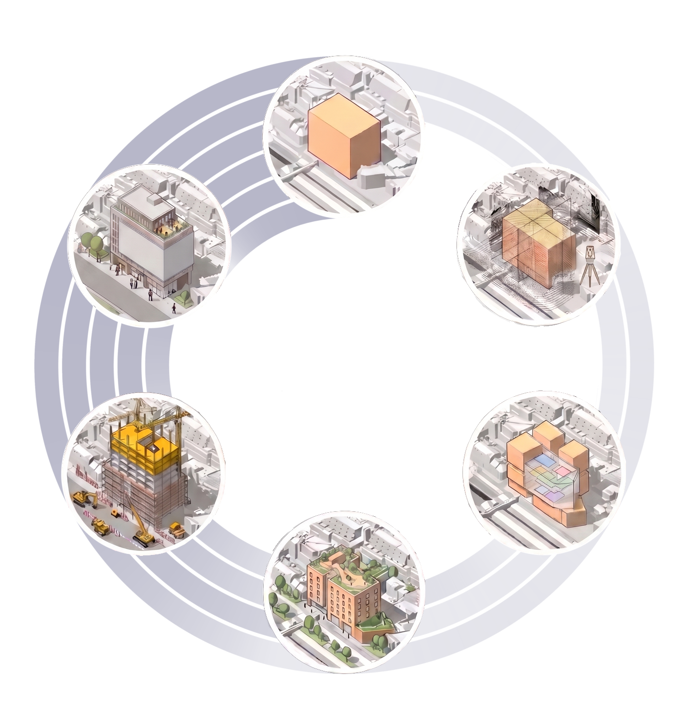 One digital twin. Six project stages. The same data, refined and reused from first viability check to final sale.
1. Viability — Is This Site Worth Pursuing?
Project: Woking
Before any capital is committed, someone needs a fast answer: is this site actually viable? The traditional route — desktop study, commissioned topographic survey, weeks of analysis — takes time you often don’t have in a competitive acquisition market.
Using drone aerial mapping and 3D Gaussian Splatting, we can put a photorealistic site model in front of a development committee within 24 hours of the drone leaving the ground. That model shows terrain, surrounding context, rights of light impacts, access routes and skyline relationships — everything a planning director needs for a first-pass viability call, without committing a single pound of professional fees to a full survey programme.
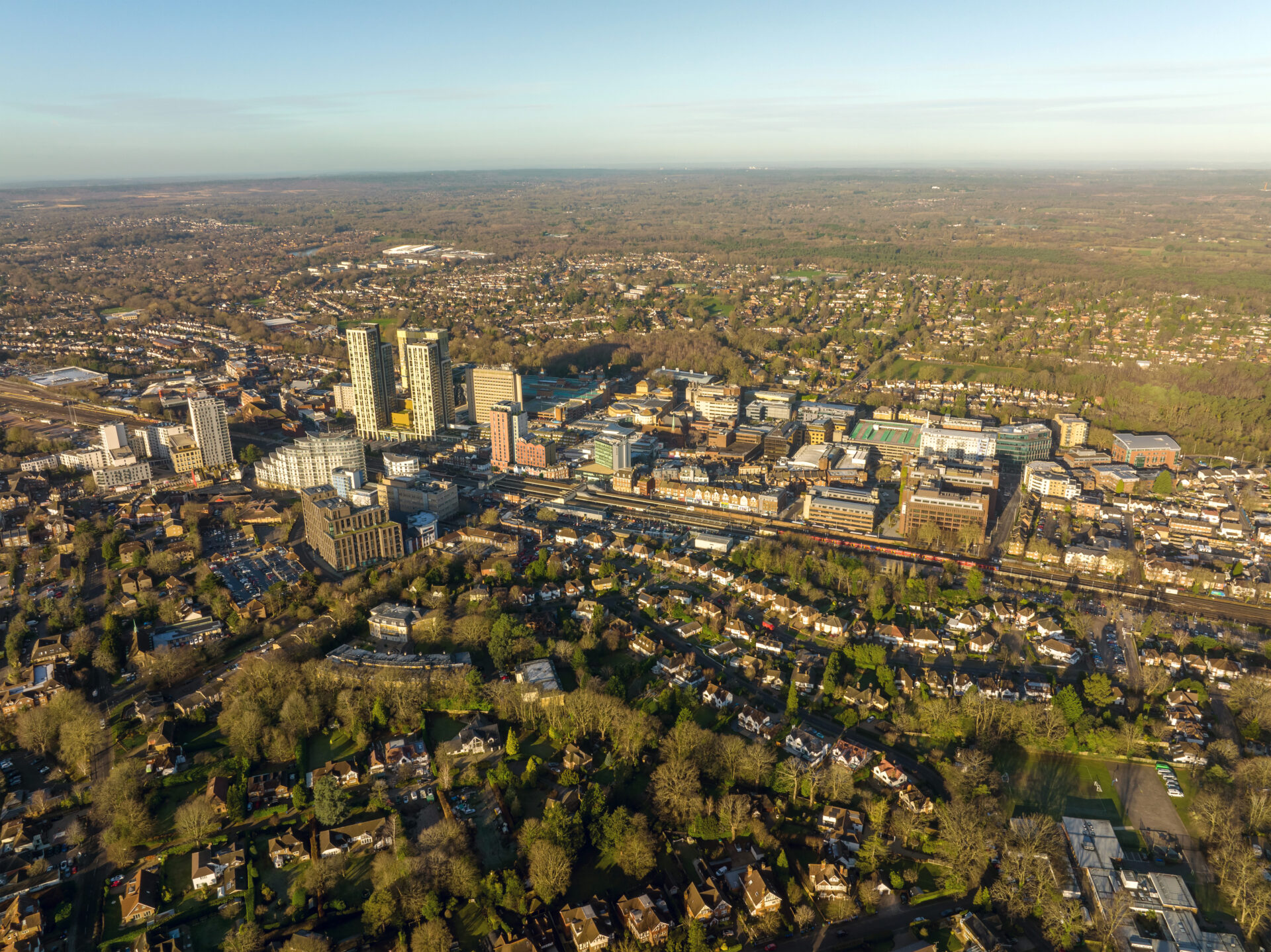
Aerial drone survey of Woking town centre. A photorealistic site model from a single drone flight, ready for stakeholder review the same day.
2. Surveying — Millimetre Accuracy on Complex Structures
Project: New Museum of London, Smithfield
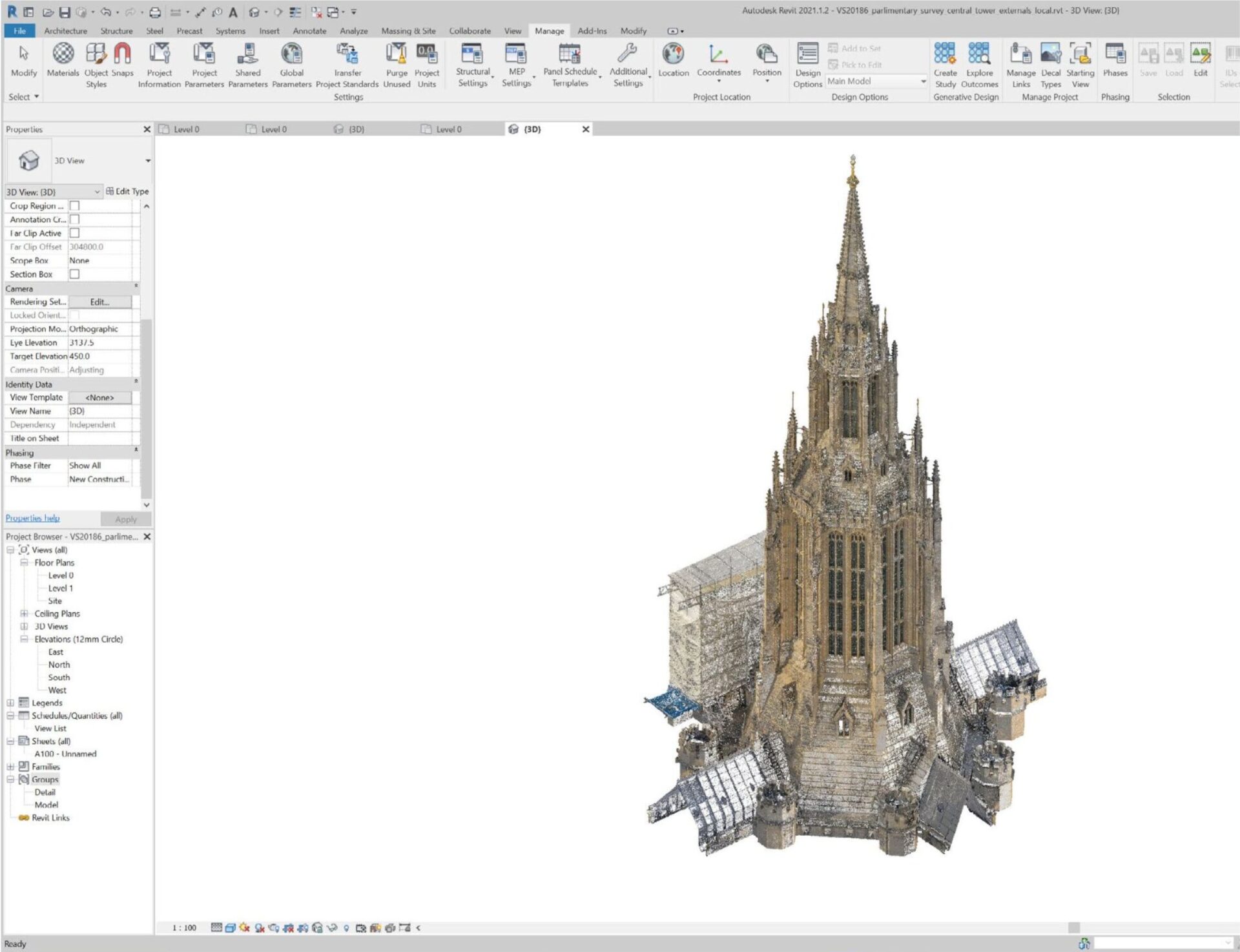
Once a site passes viability, the survey phase begins — and this is where accuracy matters most. Every design decision downstream is built on this data. Get it wrong here and you pay for it throughout the programme.
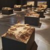
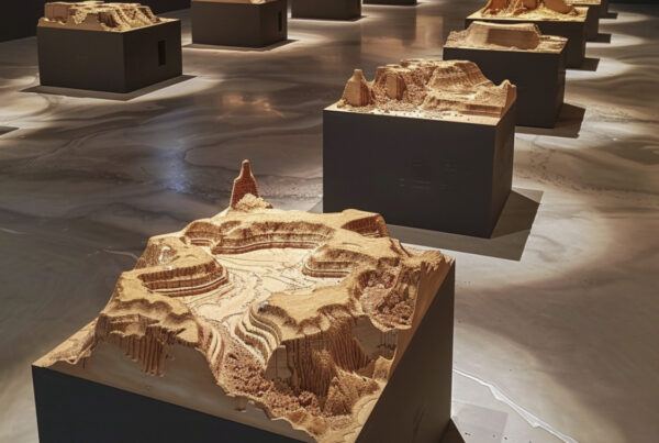
At Smithfield — the new home of the Museum of London — we combined terrestrial LiDAR with drone photogrammetry to survey the entire Victorian market hall. LiDAR drone flights strip foliage and surface clutter to produce bare-earth DTMs for drainage and foundation engineering. Terrestrial scanning captures existing structures to millimetre accuracy. And 3D Gaussian Splatting handles the elements that typically defeat photogrammetry: chain-link partitions, scaffolded sections, reflective glass roof panels — surfaces that conventional mesh processing turns into noise.
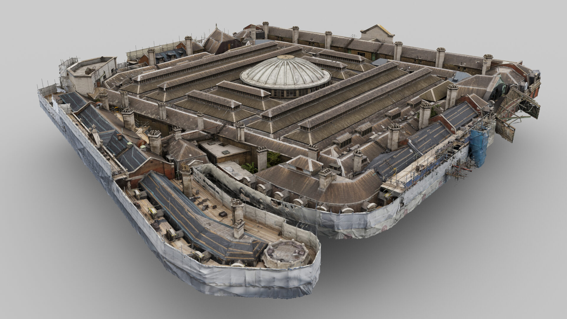
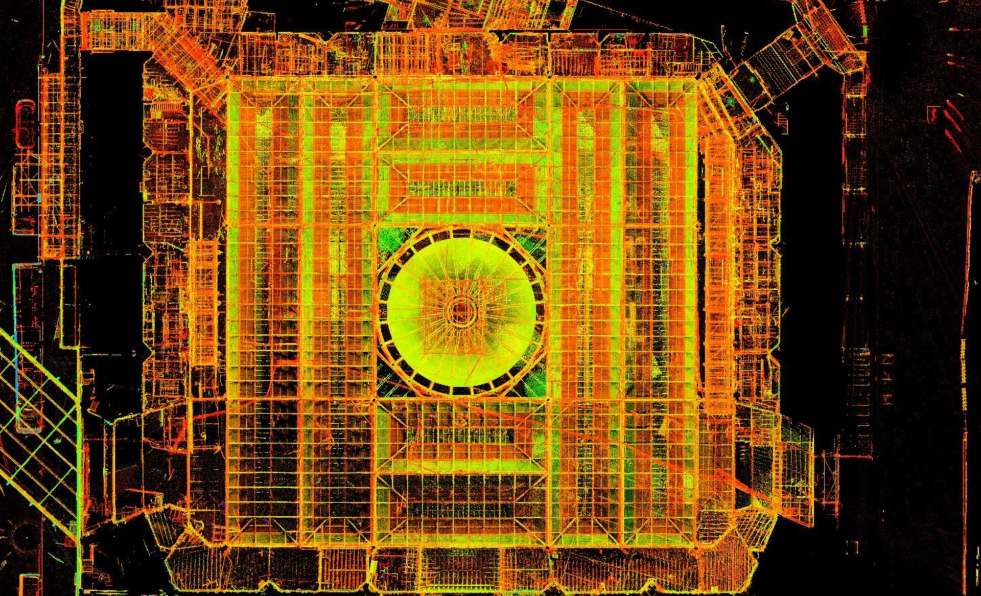
Left: photorealistic 3DGS model of Smithfield Market. Right: overhead LiDAR point cloud showing the full structural geometry of the market hall.
The result imports directly into Revit and AutoCAD. Architects and engineers work over the exact reality of the building — not a surveyor’s approximation from a decade-old drawing set.
3. Design — Building on Ground Truth
Projects: Houses of Parliament Restoration | Imperial College London
When the brief is retrofit or restoration, the design team needs to know exactly what’s there before touching anything. For listed buildings, that brief also comes with a constraint: no contact with the fabric, no scaffolding where it can be avoided, and an audit trail that proves every measurement.
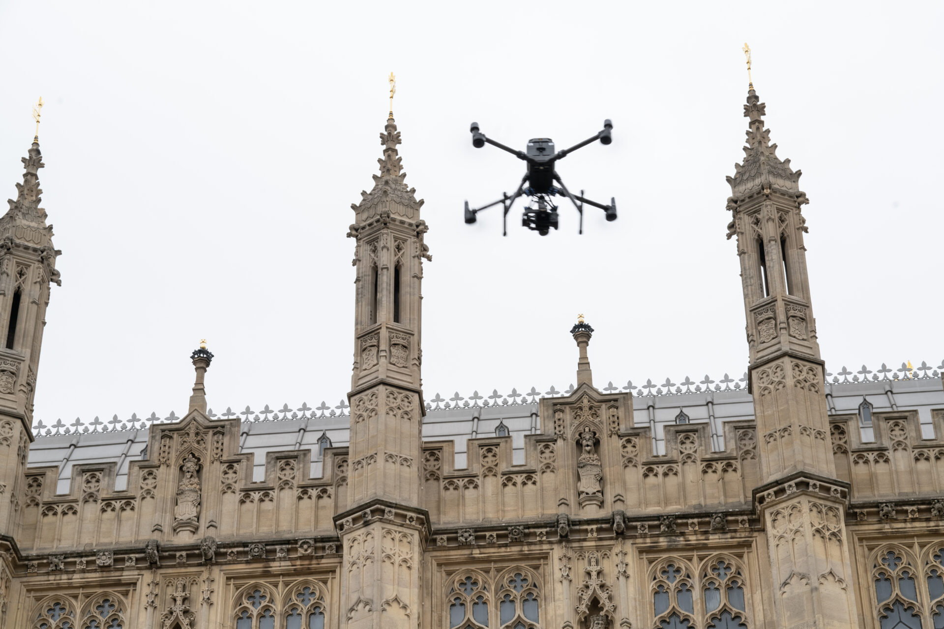
Drone survey of the Houses of Parliament roofline. Contactless capture of the fragile Gothic masonry — no scaffolding, no physical contact with irreplaceable stonework.
At the Houses of Parliament, we flew drone surveys of the exterior roofline and masonry and combined that with terrestrial LiDAR of the interior spaces. The resulting point cloud was imported into Revit, giving the conservation architects and structural engineers a millimetre-accurate 3D baseline for the entire restoration programme.

Top: photographic detail of the Parliament stone facade captured during survey. Bottom: the same structure as a 3D model in Autodesk Revit, ready for conservation design.
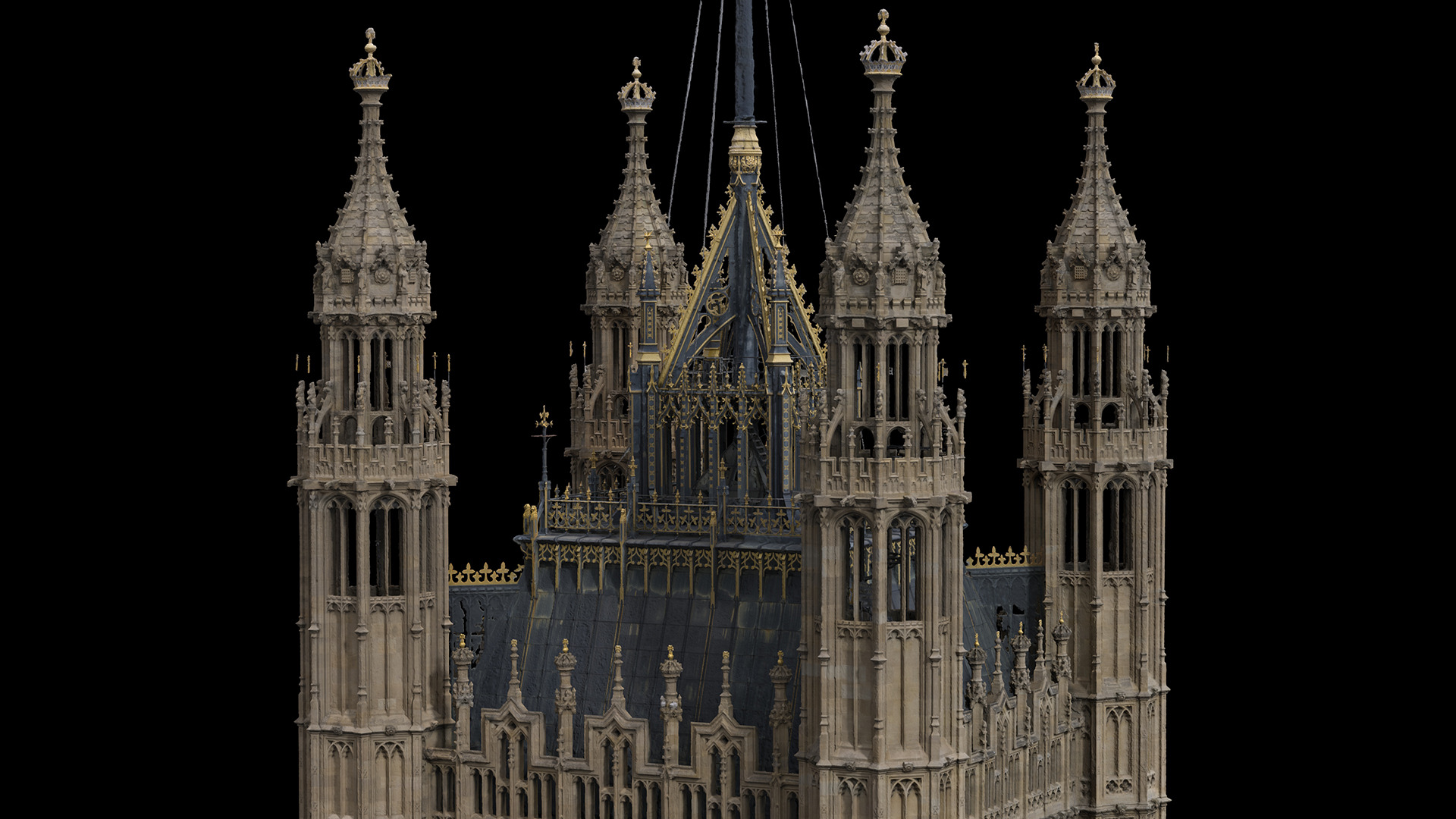
3D Gaussian Splatting model of the Houses of Parliament Victoria Tower. The gold decorative detail is captured at sub-millimetre resolution — accurate enough to plan stonework repairs without scaffolding.
We applied the same approach at Imperial College London, producing a photorealistic Gaussian Splatting model of the Queen’s Tower and the surrounding Aston Webb buildings. The geometry is accurate enough to plan facade repair works without scaffolding and detailed enough to capture individual stone condition — including the original Victorian royal cypher carved into the masonry.
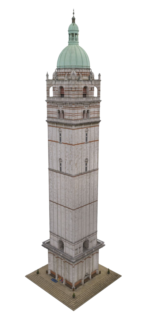
3D Gaussian Splatting model of the Queen’s Tower, Imperial College London. A complete as-built digital twin for heritage condition assessment and facade repair planning.
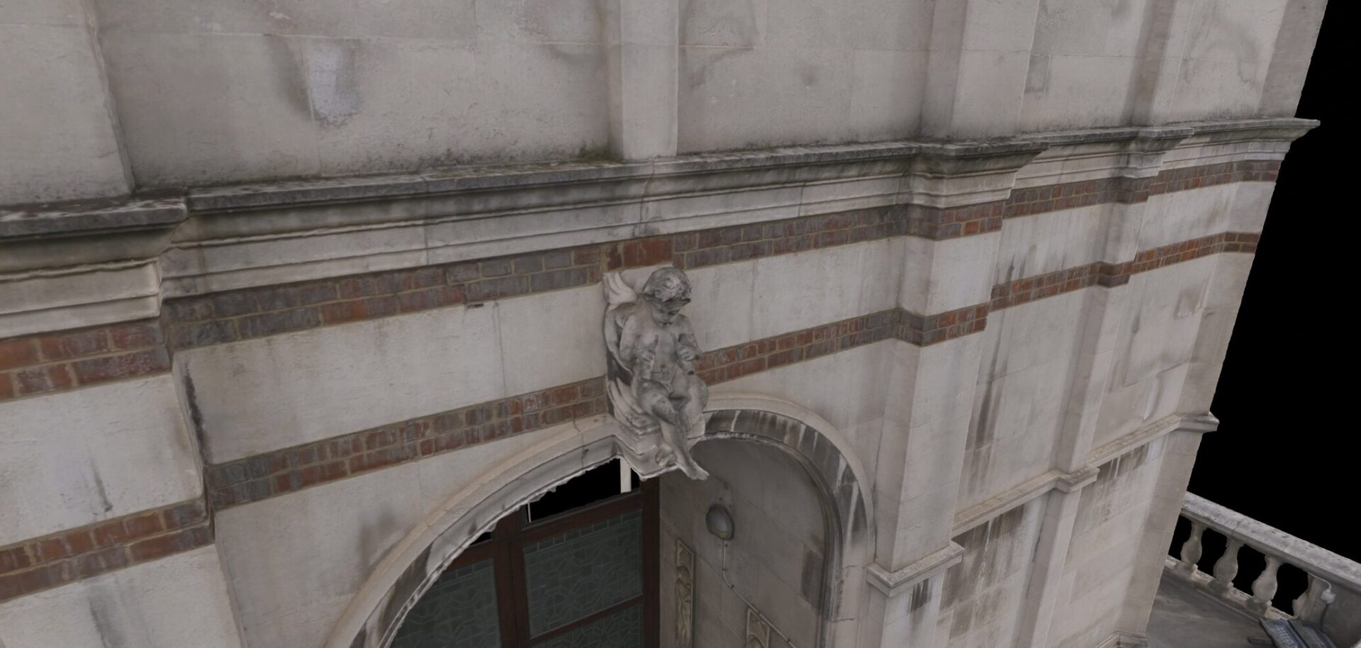
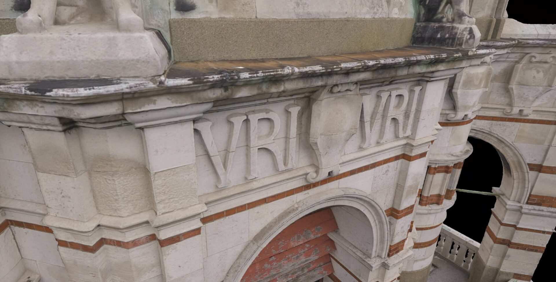
Facade detail from the ICL scan. The carved angel figure (top) and VRI royal cypher (bottom) are captured at a resolution that can inform stone conservation decisions.
4. Planning — Showing Context, Not Just Drawings
Project: Foster + Partners / Manchester United
Planning officers are not, as a rule, trained to read 2D elevation drawings. They are very good at looking at pictures — and that’s exactly the problem that 3D contextual visualisation solves.
For the new Manchester United stadium project with Foster + Partners, we provided 3D scanning of the existing Old Trafford site and surrounding neighbourhood. That real-world context data allowed the proposed design to be placed accurately within its actual environment — streets, community facilities, sightlines — rather than floating against a neutral grey background. When a planning committee can see exactly how a structure relates to what’s already there, the decision-making process moves faster and with more confidence.

The proposed new Manchester United stadium by Foster + Partners, visualised in context. 3D scanning of the existing site underpins both the planning submission and early construction logistics planning.
5. Construction — Catching Problems Before They Compound
Project: London Square, Ransome’s Wharf
Construction monitoring is one of those tasks that never gets properly funded until something goes wrong. A contractor installs ductwork in the wrong location. A concrete pour is off-axis. Another trade builds over it. By the time anyone notices, the remediation cost is ten times what a weekly scan would have cost.
At London Square’s Ransome’s Wharf development on the Thames, automated drone flights on a regular cadence give site managers near-real-time 3D updates of construction progress. The 3D Gaussian Splatting pipeline processes each new flight quickly, so stakeholders anywhere in the world can compare current progress against the design BIM without waiting weeks for a photogrammetry deliverable.
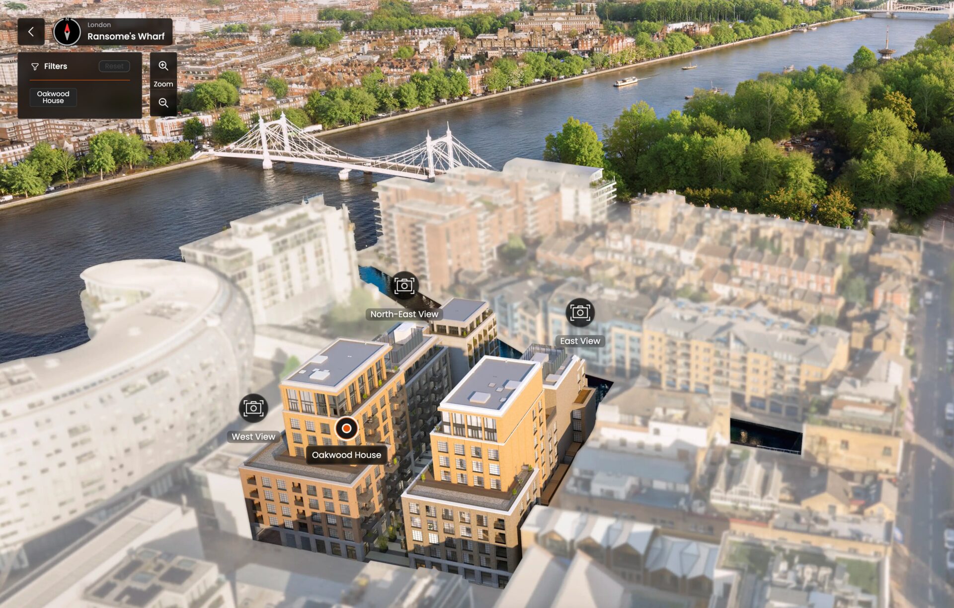
Ransome’s Wharf, London Square — Oakwood House development on the Thames. The same 3D context model that informed construction monitoring feeds directly into the marketing platform.
6. Marketing — Selling Before the Concrete Sets
Project: London Square, Ransome’s Wharf
The part that tends to surprise developers: the same digital twin built at viability, refined through survey and used throughout construction, is also the asset that drives pre-sales.
Because we come from film and TV VFX, we don’t just provide raw engineering data. For Ransome’s Wharf, we exported the development model into an interactive 3D sales platform developed by Soluis. Prospective buyers can navigate around and through a building that doesn’t yet exist — exploring apartments, checking river views, understanding the site in context from any angle. The sales team can update the model as the design evolves without commissioning a full re-shoot.

The Ransome’s Wharf interactive marketing platform — buyers explore Oakwood House from any angle, with unit availability and specification overlaid on the 3D model.
And because it’s built from the same geometric data as the construction and design models, the sales assets are mathematically consistent with the building being constructed. The marketing team isn’t selling a different building from the one the engineers are building.
One Workflow. Every Stage.
The lifecycle diagram at the top of this post shows this as a circle deliberately. Survey data created at viability gets refined and reused through design, planning, construction and marketing. The digital twin that costs £X at the start of a project isn’t a one-time expense — it’s the foundation for every subsequent stage.
Most of our AEC clients come to us at a single stage and end up covering more of the cycle as the project progresses. A few have been with us from first feasibility through to marketing suite. That’s when it really works.
If you’re working on a project where this kind of continuity would make a difference, get in touch and we can talk through what makes sense for your specific brief.
Need 3D Gaussian Splatting for Your AEC Project?
LiDAR survey, drone mapping, 3D Gaussian Splatting and interactive visualisation — from viability to marketing suite.