When it comes to bringing a beloved character like Paddington Bear to life on screen, the world he inhabits must feel as vivid, whimsical, and immersive as the story itself. For Paddington in Peru, the latest chapter in the globe-trotting bear’s adventures, the filmmakers sought to push visual storytelling further – and that’s where we came in.
At Visualskies, we specialise in delivering high-resolution scanning, aerial photogrammetry, and LiDAR data for a range of sectors, including film, TV, and heritage applications. But every so often, a project presents itself that not only challenges our capabilities but also leaves a lasting emotional and cultural impact. Paddington in Peru was one of those rare moments.
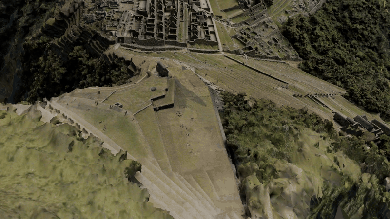
From the mist-covered peaks of the Andes to the dense Colombian jungle and the picturesque countryside of southern England, we had the privilege of using our lidar and drone technology to capture environments that would form the digital backbone of the film’s visual effects. At the centre of this journey was a site of profound global significance: Machu Picchu.
Watch the official trailer for Paddington in Peru, featuring environments scanned and digitally recreated by Visualskies using aerial photogrammetry and LiDAR
An Unforgettable Honour: Scanning Machu Picchu
Few locations on Earth are as iconic and sacred as Machu Picchu. Recognised as a UNESCO World Heritage Site and one of the New Seven Wonders of the World, this Incan citadel is not only a marvel of ancient engineering – it’s a symbol of Peru’s cultural identity. Being granted permission to scan the site was an extraordinary privilege, and one we approached with deep respect and technical precision.
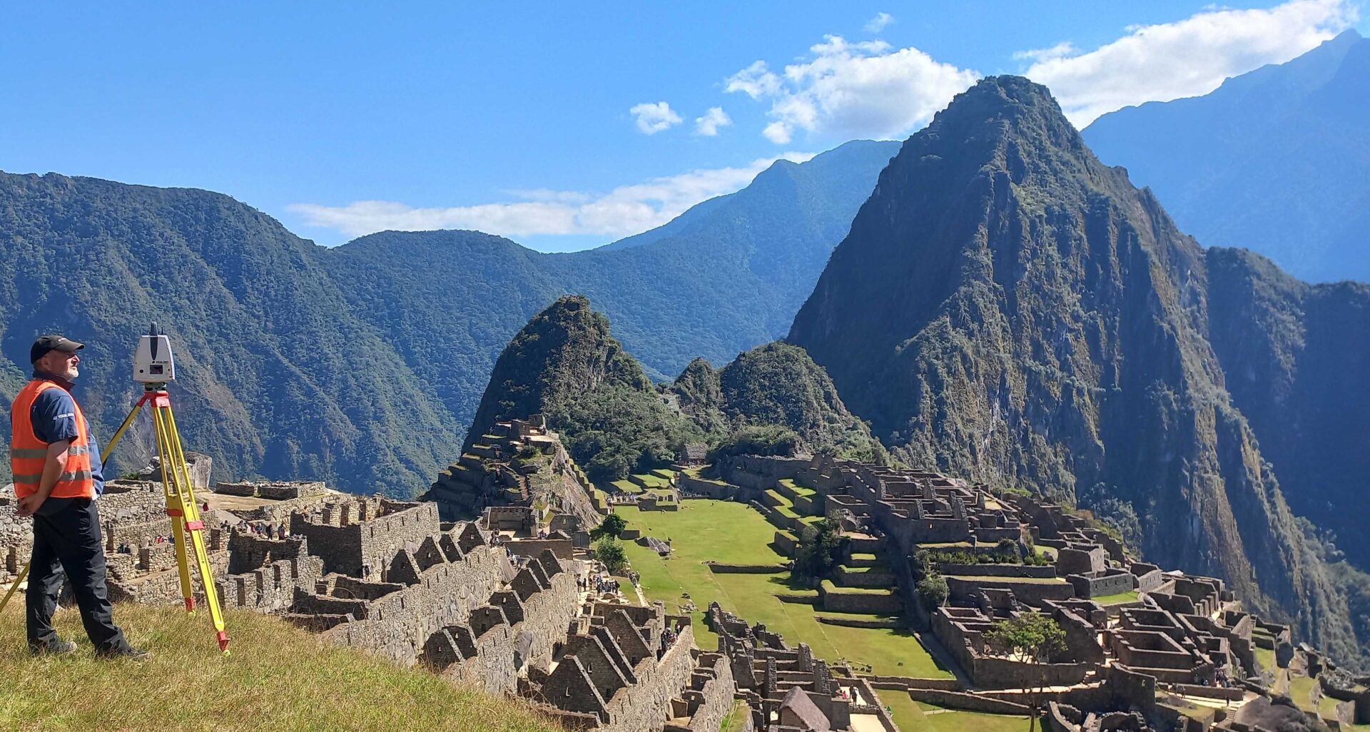
Our goal was to digitally capture Machu Picchu in its entirety using non-invasive aerial photogrammetry and terrestrial LiDAR scanning methods. Operating at over 2,400 metres above sea level, we had to contend with high altitudes, shifting weather, tight flight windows, and strict environmental guidelines. This was far from a typical drone job. To support the work, we deployed Leica’s high-precision laser scanners – the P50 and RTC360 – to provide dense and accurate spatial data that complemented our aerial capture and ensured exceptional fidelity in complex areas
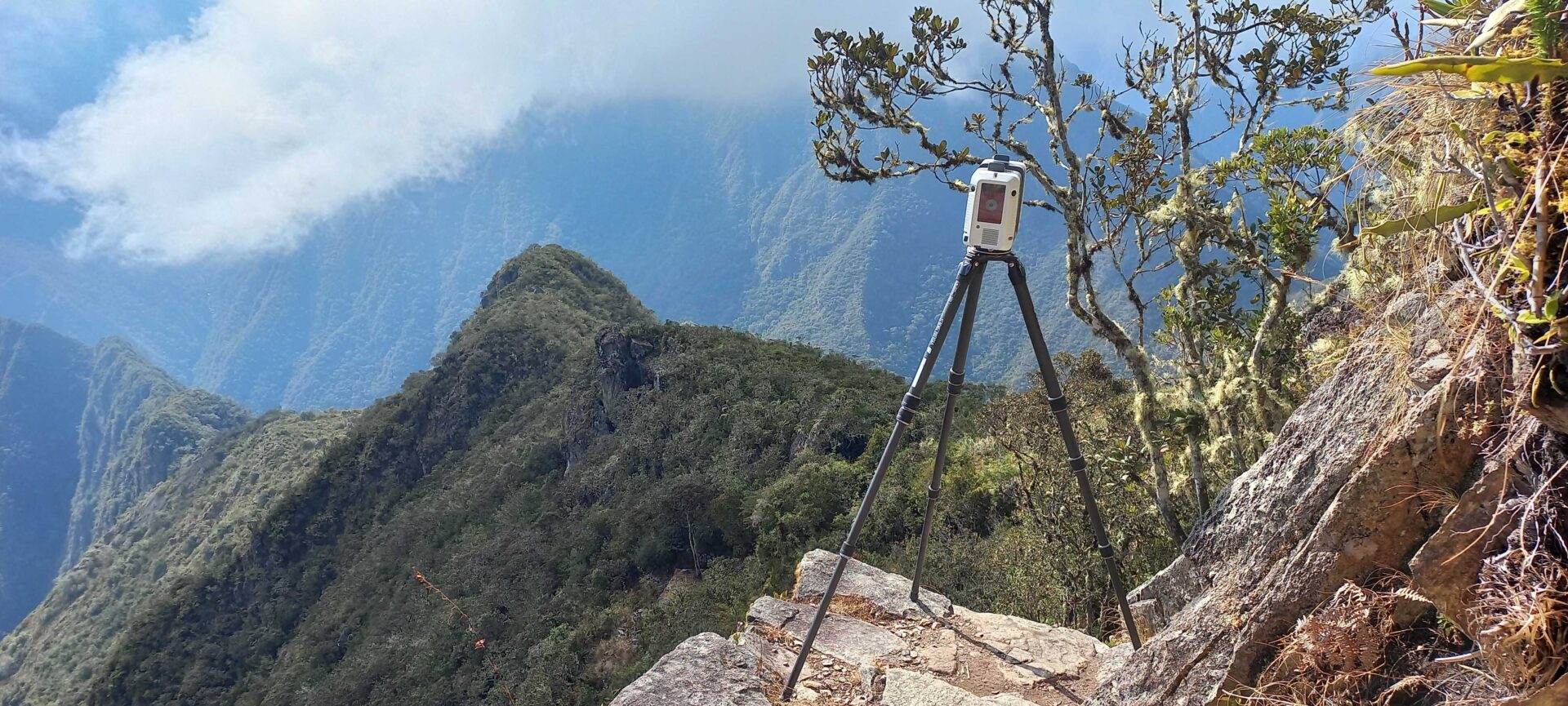
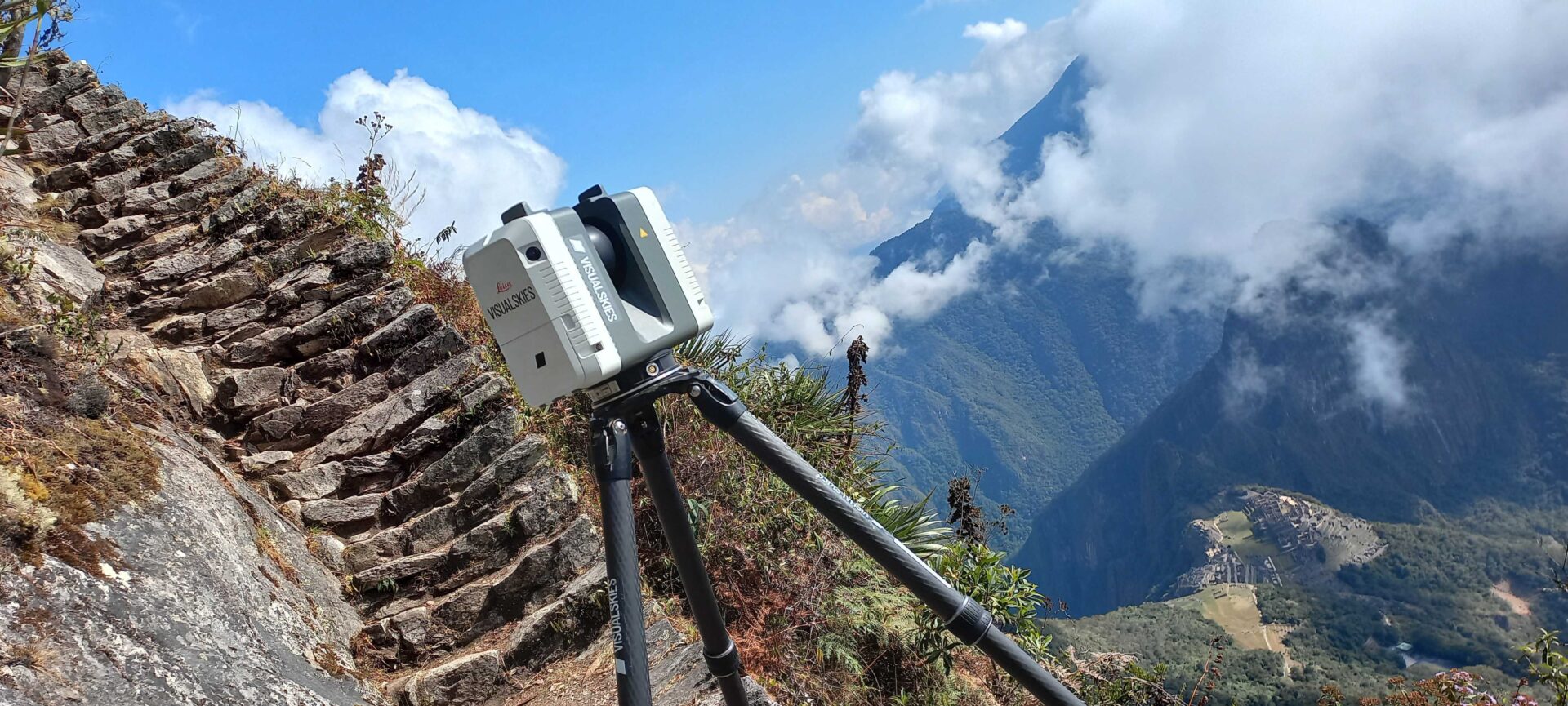
We combined aerial photogrammetry with terrestrial LiDAR, harnessing the power of Leica’s RTC360 and P50 scanners.
Why We Fly DJI
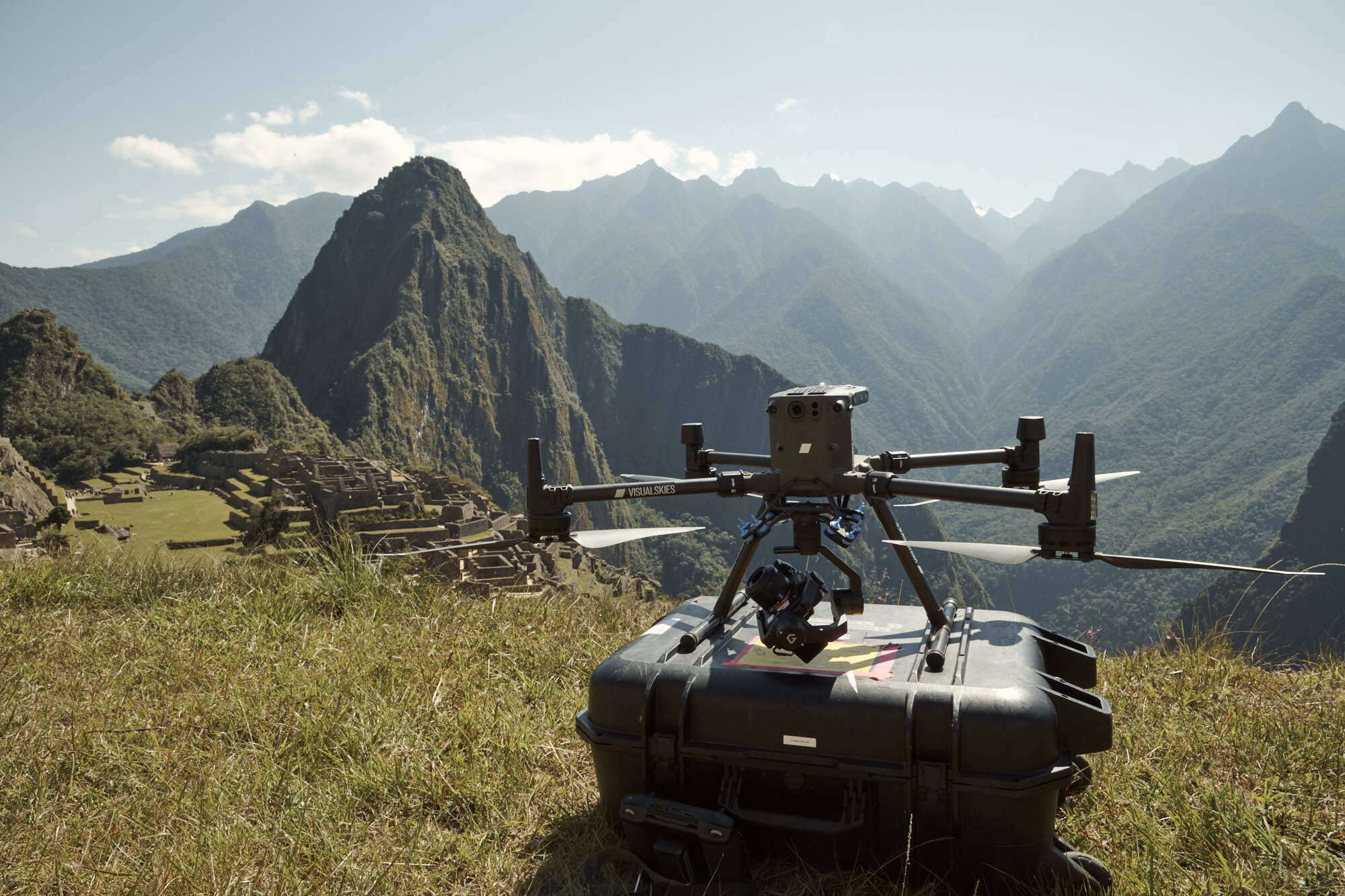
When choosing drone platforms for high-stakes projects like this, reliability isn’t a luxury – it’s a requirement. That’s why we consistently turn to DJI Enterprise systems. For Paddington in Peru, we deployed the DJI Matrice 300 RTK, paired with the Sony A7RIV using the Gremsy Pixy SM gimbal. This setup allows us to match our aerial data precisely with our terrestrial photogrammetry – streamlining our workflow and maintaining consistency in quality and format across all capture types.
The M300 RTK offered the ideal mix of endurance, stability and modularity. It allowed us to integrate our preferred photogrammetry camera systems and fly confidently in unpredictable mountain conditions. With centimetre-level positional accuracy, we were able to capture data robust enough for VFX workflows without the need for extensive ground control in difficult terrain.
What really sets DJI apart for us is their ecosystem’s adaptability. Whether it’s tight urban filming or large-scale rural survey missions, the DJI platforms we use allow us to remain agile, precise and compliant with international drone regulations.
And when you’re flying in a location like Machu Picchu – a site where every moment in the air matters – that combination of precision and peace of mind is everything.
Aerial photogrammetry was completed by Lydia Fauser, with supporting terrestrial data captured by Duncan Lees, and Mat Hay.
Powered by Partnership: Our Collaboration with heliguy
Our ability to deploy these advanced aerial systems wouldn’t be possible without the support of trusted partners like heliguy. As one of the UK’s leading DJI Enterprise suppliers, heliguy have played an essential role in keeping our operations streamlined, responsive, and future-ready. Whether it’s advising on hardware integrations, facilitating repairs or ensuring timely equipment access across borders, their team has become a reliable extension of our own. Their expertise and logistics support were particularly valuable during our international work on Paddington in Peru, helping us keep things moving smoothly in high-pressure environments.
The Role of Drone Technology and Aerial Photogrammetry in Film
For a film like Paddington in Peru, aerial photogrammetry isn’t just a pretty extra – it’s a core tool for environmental realism. Our scans inform set extensions, digital twins, and virtual environments that seamlessly blend with on-location footage. The data we captured was handed over to VFX vendors who could then recreate scenes that were logistically impossible to film directly.
In Peru and Colombia, we scanned towering mountain passes, forest canopies, and ancient ruins. In England, we brought our scanners to charming countryside lanes and village squares that would stand in for parts of Paddington’s journey.
Each of these scans began with drone-based image capture, structured flight paths, and precision data logging. We process these datasets into textured meshes and point clouds that can slot directly into production pipelines. With the help of DJI’s platform stability and flexibility, we’re able to maintain consistency across vastly different geographies and altitudes.
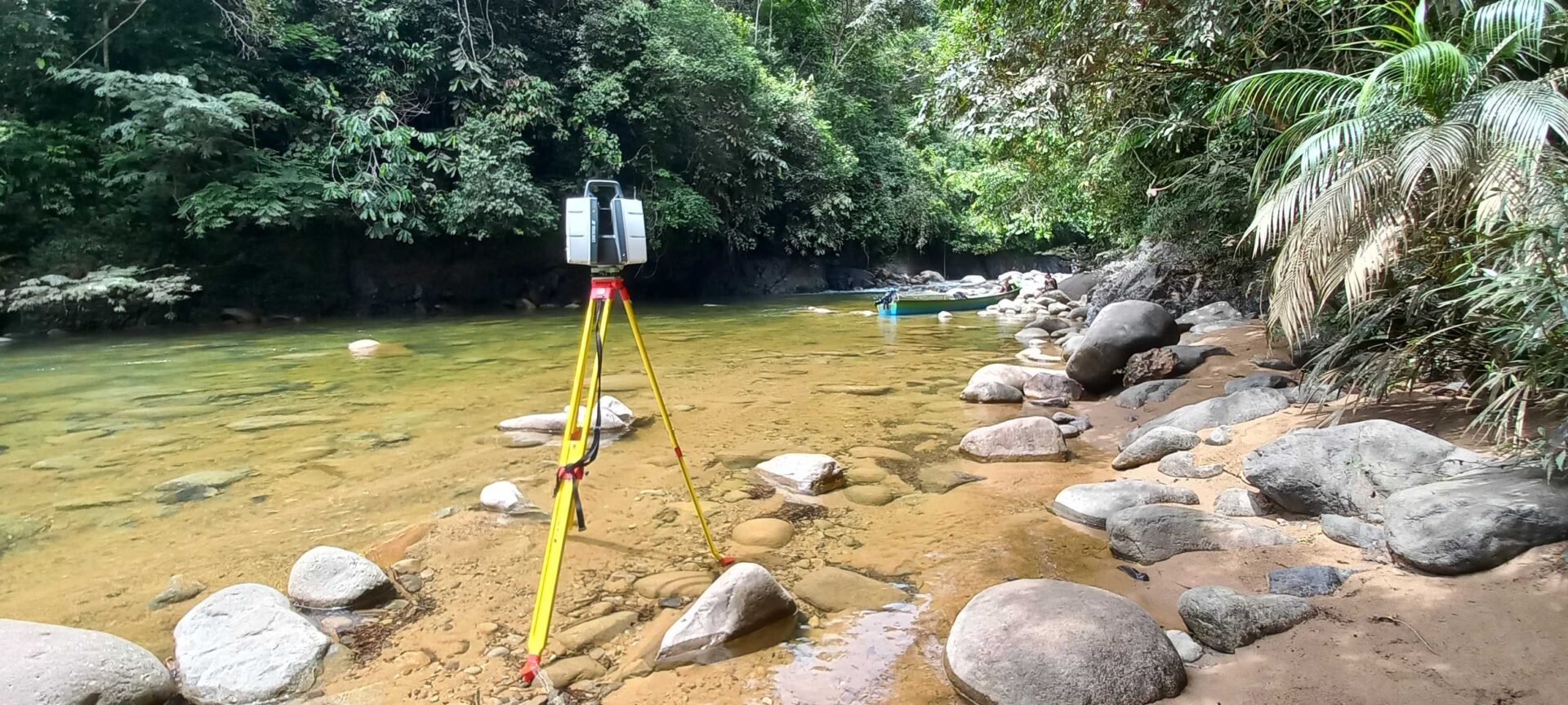
The Human Side of the Mission
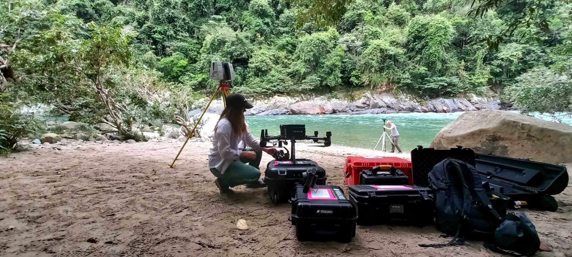
Setting up LiDAR and survey equipment in the Colombian jungle, combining traditional ground control with advanced capture tools
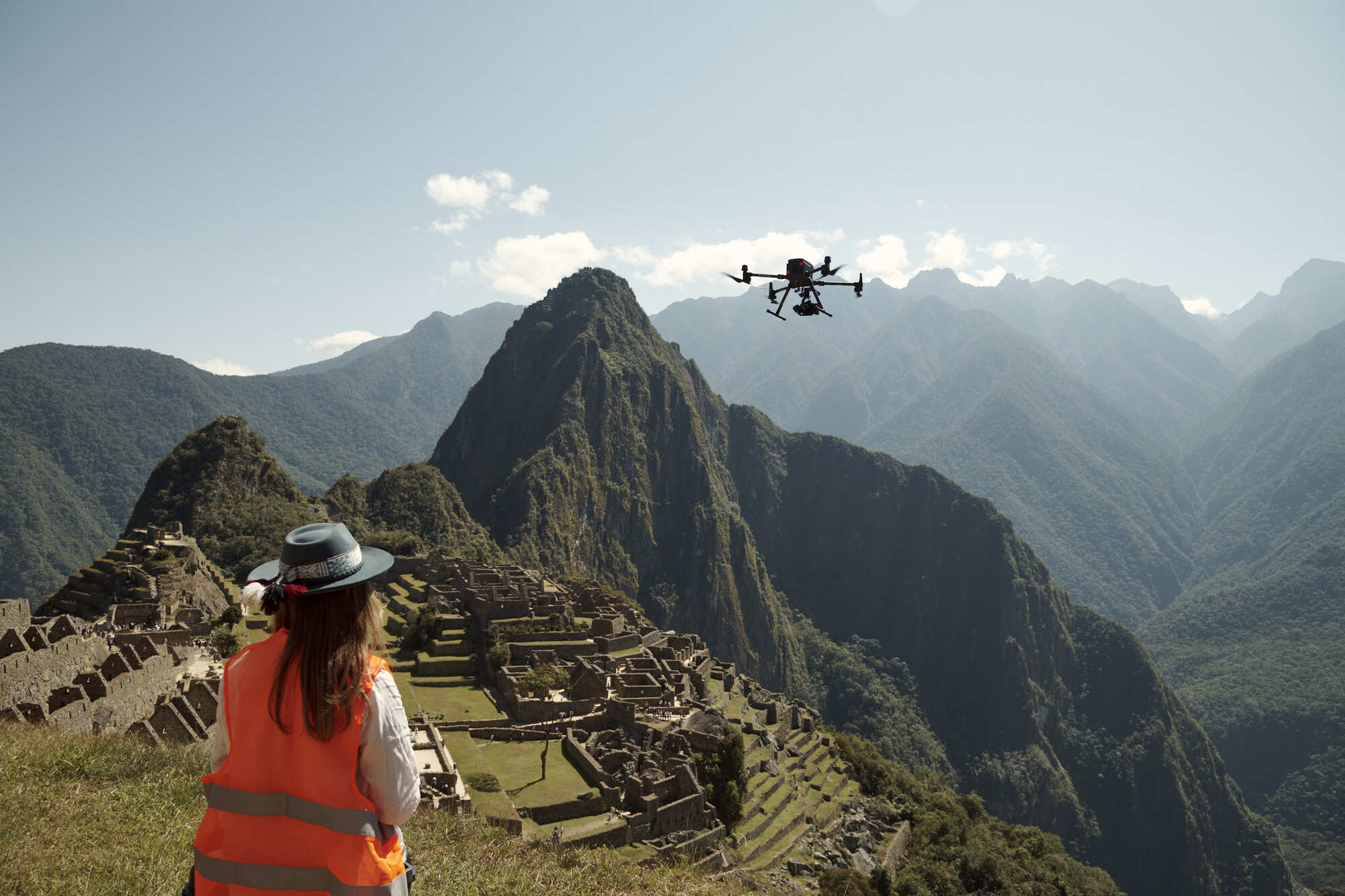
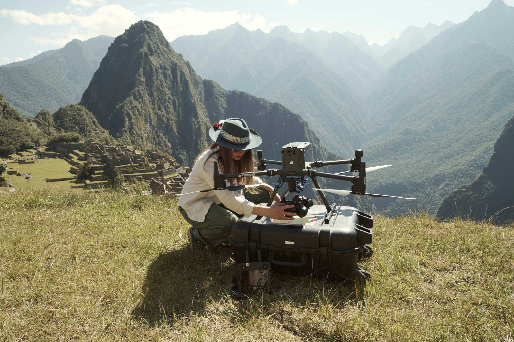
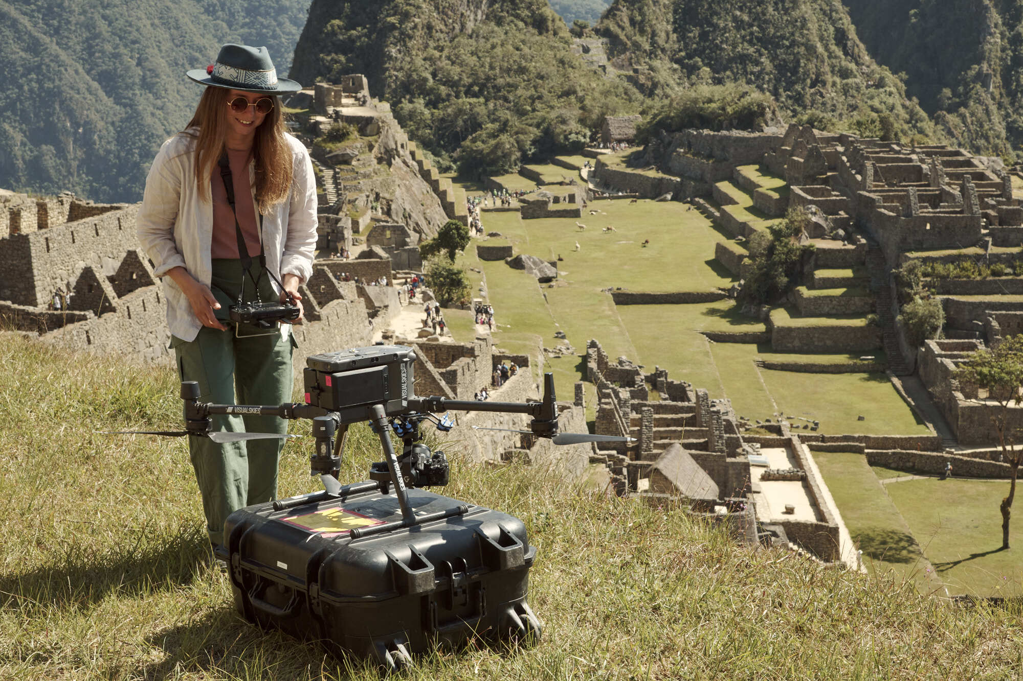
It’s easy to get lost in the tech. But behind every scan, every mesh, and every photogrammetry flight lies a talented team of individuals who make it all possible. One of the proudest aspects of this project was the incredible work by our drone pilot Lydia Fauser, whose skill and adaptability were vital in safely capturing data at Machu Picchu.
Flying drones in high-altitude, heritage-protected areas demands more than just licensing and experience. It requires a calm presence, exceptional spatial awareness, and the ability to make quick decisions without compromising the environment or the mission. Lydia embodied all of that and more.

Drone pilot Lydia Fauser capturing aerial data over Machu Picchu, a high-stakes environment that demanded precision and care.
Pushing Boundaries, Respectfully
Working in an environment like Machu Picchu isn’t about showing off what the tech can do – it’s about doing justice to a place that holds deep meaning for millions of people. That means adapting workflows to the environment, not the other way around.
We made lasting connections with authorities and cultural heritage consultants to ensure every aspect of our work was aligned with the highest ethical and conservation standards. From pre-flight planning to post-capture data handling, we made sure our presence left no trace, only high-fidelity digital records to support cinematic storytelling.
This respectful approach is a core part of how we operate at Visualskies. Whether we’re scanning castles in England or citadels in Peru, our mission is the same: to capture the magic of real-world spaces without ever compromising their integrity.
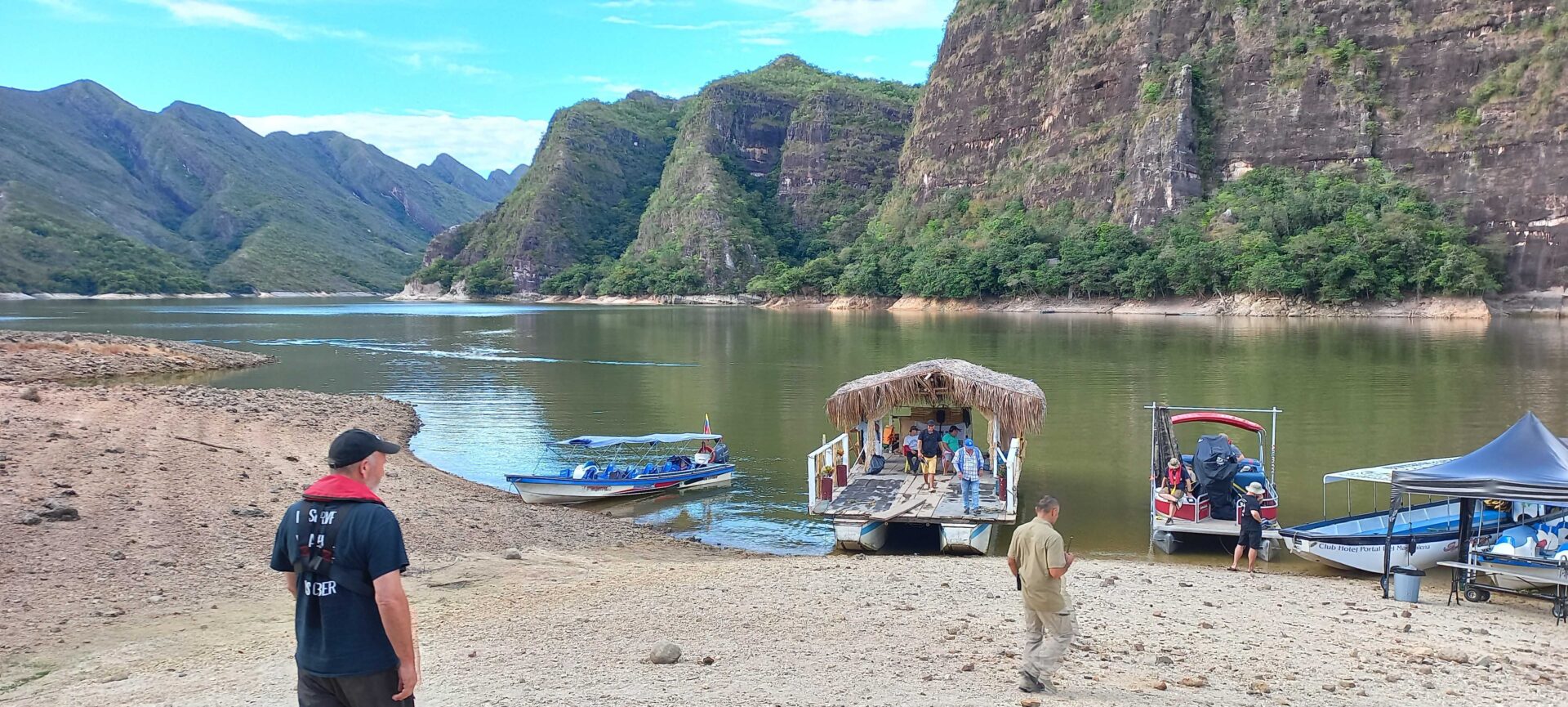
Navigating through the Colombian jungle by boat, the crew accessed remote locations to capture essential photogrammetry and LiDAR data.
The Payoff: A Film That Feels Real
In the final film, audiences won’t necessarily think about drones or mesh resolutions. They’ll see a curious bear exploring the world around him – and that world will feel grounded, beautiful and true. That’s the magic of what we do.
Our scanning work made it possible for filmmakers to recreate locations exactly as they appeared, or to build them out into larger scenes that still respected the geography and texture of the original environments. From the tilt of a mountain ridge to the erosion lines in ancient stone, our data allowed visual effects teams to match reality down to the millimetre.
And thanks to DJI’s technology, supported by Gremsy gimbals and our trusted suppliers, we were able to do that safely, reliably and with absolute confidence.
Looking Forward
Paddington in Peru was a project that reminded us why we do what we do. It stretched our technical muscles, deepened our cultural awareness and gave us the chance to contribute to a story beloved by audiences around the world.
At Visualskies, we’re always chasing the next adventure – the next challenge that requires equal parts art, science and human intuition. With DJI drones in our kit, Leica scanners in hand, and trusted collaborators like heliguy behind the scenes, we’re more ready than ever to keep capturing the world’s wonders – one scan at a time.


👉 Follow us on Instagram 👉 Like our Page on Facebook 👉 Subscribe to our YouTube Channel 👉 Connect with us on LinkedIn
WHERE TO FIND US?
Visualskies is proud to offer our expert Photogrammetry services for VFX across multiple locations worldwide. Our presence in key cities enables us to provide prompt and efficient service to our clients. You can find us in the following locations.
GLOBAL BASES
LONDON
Unit 4S Hewlett House, Battersea
SW8 4AS, UK
BERLIN
Wilhelminenhofstrasse 92
12459, Germany
NYC
546 West 48th St
NY 10036, USA
ITALY
Via Fratelli Lumiere, 86/c
52100 Arezzo
HONG KONG
20 Wang Hoi Road
Kowloon Bay, HK