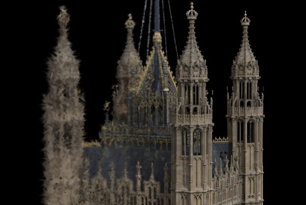
For the first series of Lost Cities with Albert Lin, National Geographic and Blakeway TV Productions asked Visualskies to do something television rarely attempts: survey ancient sites to a scientific standard, then turn the data into pictures an audience could feel. Over five locations on four continents we flew aerial LiDAR, laser-scanned on the ground, captured thousands of photogrammetry images per site and built an augmented reality app so Albert could stand in a ruin and see the city as it once was.
Key takeaways
- Five lost-city sites scanned for National Geographic: Akko (Israel), the Nabataean sites around Petra (Jordan), the Pre-Inca highlands of Peru, Ciudad Perdida (Colombia) and Nan Madol (Micronesia).
- Drone-mounted GeoSLAM ZEB Horizon LiDAR saw through jungle canopy to reveal terraces and structures invisible to the naked eye.
- Leica P50 terrestrial scans supplied the “ground truth”, fused with 5,000+ aerial photogrammetry images per site into photoreal 3D models.
- Our VS Scout AR app put the processed data in Albert’s hands on location, on camera.
The brief: science first, story second
We worked closely with Albert and the Blakeway crew to build each episode’s narrative around a genuine spatial survey. Rather than inventing visuals, every reconstruction started from measured data: aerial LiDAR to cover landscapes quickly, terrestrial LiDAR for millimetre-level detail, and photogrammetry to texture it all. The result was a series that delivered powerful, emotional stories with imagery grounded in real measurements.
Client: Blakeway TV Productions for National Geographic · What we did: 3D surveying, aerial and terrestrial LiDAR, aerial photogrammetry, AR app development, CGI and VFX.
Akko, Israel: the Crusader city beneath the city

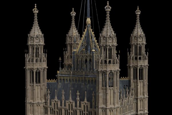
Working in Akko (Acre) was a journey into one of the most remarkable cities on earth. To explain its layered remains we worked in the air, on the ground and, for much of the time, underneath it. A GeoSLAM ZEB Horizon payload flown on a local operator’s drone captured multiple locations across the town in a short window, while a Leica P50 recorded sub-millimetre detail on the ground. Combining the two with more than 5,000 aerial photographs produced a large-scale, high-accuracy, photorealistic model of Acre, and our custom AR software let Albert step back into the city of the Crusaders.
Petra’s hidden origins, Jordan: scanning the Nabataean hinterland
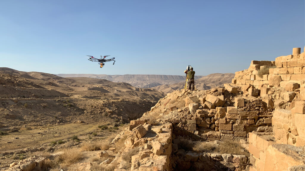
This episode explored the little-known backstory to Petra. We digitised the Nabataean temple at Khirbet al-Dharih and the vast ancient field systems at Ras al-Silaysil, but the toughest location for the team and the kit was Sela: a mountain-top stronghold above the Edom Plateau, more than 3,000 years old and reachable only by a single stairway cut into the rock. Its water channels and cisterns may hold lessons later applied at Petra itself.
Flying the ZEB Horizon on our DJI M600 Pro gave 25-minute flights that covered huge areas of landscape per sortie, with dual photogrammetry cameras capturing even more. Leica P50 scans tied the aerial data to the ground for a photoreal 3D model of Sela.
Island in the Sky, Peru: Pre-Inca sites above 4,000 metres
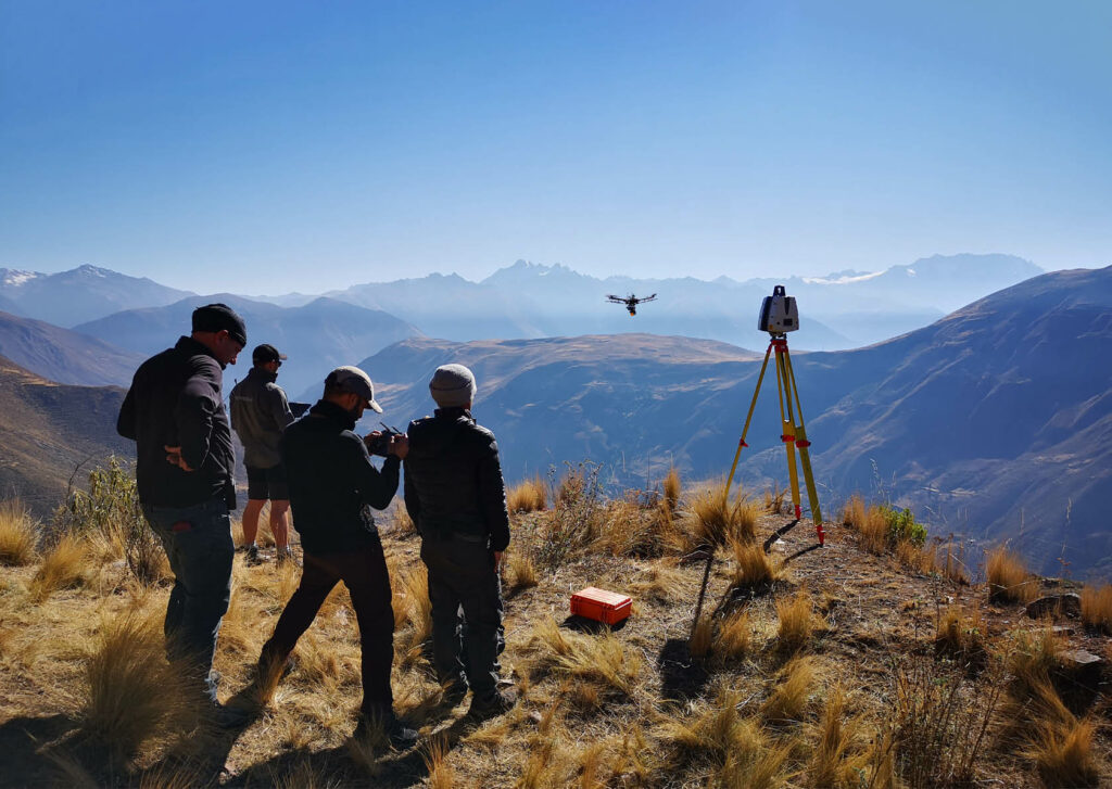
The series finale searched for what taught the Incas to build Machu Picchu. That took us to the Pre-Inca City of the Dead at Rayallaqta, into the remains of a volcano at Raqchi, and finally to the mountain-top site of Wat’a, more than 4,000 metres above sea level. Beyond the trek with all the equipment and the altitude sickness, simply keeping drones airborne in the thin atmosphere was a challenge; our M600 was modified for the conditions and every flight combined LiDAR with photogrammetry.
Fusing aerial and terrestrial LiDAR with photogrammetry let the team find signs of settlement hidden in vegetation and all but invisible to the eye. Processing in tents on two temperamental generators, we helped unravel the sequence of settlement on this Island in the Sky, suggesting the builders of Machu Picchu had learnt their lessons long before.
Ciudad Perdida, Colombia: finding a lost city with VS Scout
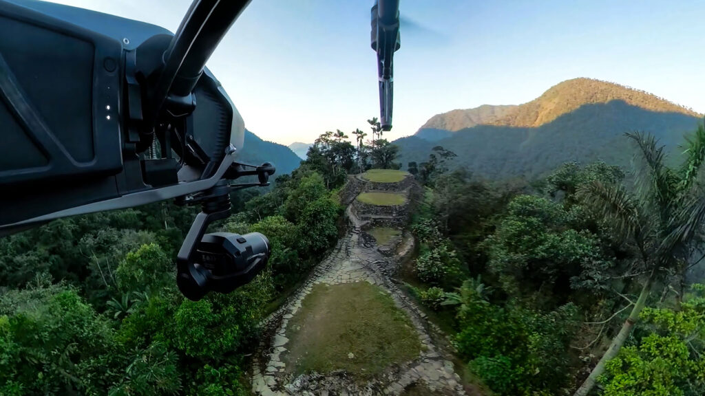
Built by the Tayrona people more than 1,000 years ago, Ciudad Perdida (Teyuna) is a city of around 170 terraces carved into the Sierra Nevada de Santa Marta, reached by some 1,200 stone steps through dense jungle. Almost the whole complex is hidden under tree cover, so traditional survey alone could never document it, let alone find what lies beyond it.
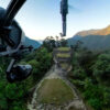
The crew flew in by helicopter with laser scanners, cameras and drones. We used drone and helicopter-mounted LiDAR to penetrate the canopy, stripping away vegetation to reveal previously undiscovered terraces, with terrestrial LiDAR and 5,000+ images building a photoreal model of the site. We also delivered 6K plates and 360-degree video for the film. Albert then explored the new data in our VS Scout AR app and led the crew into uncharted territory in search of more of the lost city.
Nan Madol, Micronesia: LiDAR through the rainforest
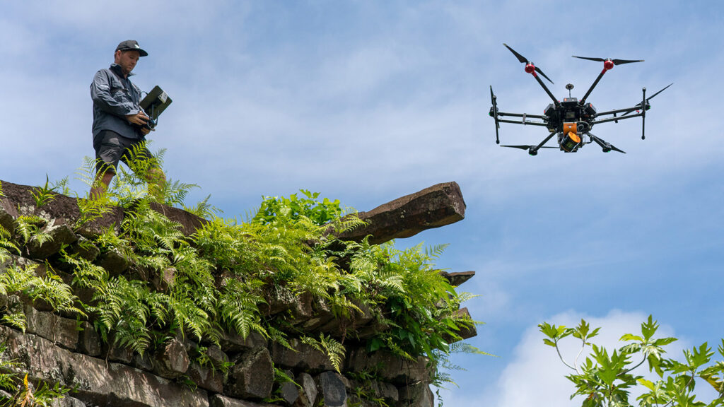
At Nan Madol, the drone-mounted ZEB Horizon collected data across tropical rainforest, penetrating the canopy to reveal the remains of the lost city in digital form. Read the full story in Aerial LiDAR: Nan Madol.
In the press: GeoSLAM’s case study
GeoSLAM featured our Lost Cities work in a case study on why we chose the ZEB Horizon: its adaptability, and the option to mount it on a drone, were key to finding ancient cities under thick jungle. In it, Visualskies 3D scanning specialist Duncan Lees explains how the drone-mounted scanner revealed Nan Madol through the tree canopy.
The toolkit
- Aerial LiDAR: GeoSLAM ZEB Horizon on drones (DJI M600 Pro, modified for high altitude) to survey large landscapes and see beneath vegetation.
- Terrestrial LiDAR: Leica P50 for high-accuracy ground truth and fine architectural detail.
- Aerial photogrammetry: 5,000+ images per site, fused with LiDAR for photoreal textured models.
- AR and VFX: the VS Scout app for on-location visualisation, plus CGI renders and VFX breakdowns for broadcast.
Series 2 on Disney+
We returned for the second series. Read Uncovering the Past: Visualskies and Lost Cities with Albert Lin on Disney+ UK.
Frequently asked questions
What did Visualskies do on Lost Cities with Albert Lin?
We provided the 3D survey for the series: aerial and terrestrial LiDAR, aerial photogrammetry, an augmented reality app and CGI/VFX, working with Blakeway TV Productions for National Geographic.
How can LiDAR find ruins hidden under jungle?
Laser pulses from a drone-mounted scanner pass through gaps in the canopy and some return from the ground. Filtering out the vegetation leaves a bare-earth model in which terraces, walls and paths stand out, even where they are invisible on the ground.
Which sites were scanned?
Akko in Israel; Sela, Khirbet al-Dharih and Ras al-Silaysil near Petra in Jordan; Rayallaqta, Raqchi and Wat’a in Peru; Ciudad Perdida in Colombia; and Nan Madol in Micronesia.
What is VS Scout?
VS Scout is Visualskies’ augmented reality app for viewing processed 3D scan data on location. On Lost Cities it let Albert Lin see reconstructed sites and newly revealed features on camera.