Trust the Process
Some projects can’t tolerate “close enough”. When a digital model is used to design a new fitting, check a structure or plan works on a building that can’t be touched, a few centimetres of error isn’t good enough.
At Visualskies we capture data to millimetre accuracy. That comes from a solid pipeline, not just from specialised kit. Terrestrial LiDAR is collected for the survey-grade backbone, photogrammetry for detail and texture, and careful processing in Leica Cyclone and RealityScan brings the two together. Each step checks the one before it and, if the process is followed properly, the result is a digital double you can measure from with confidence.
This blog explains how that process works, and then looks at four projects where millimetre-accurate Visualskies data was essential.
Step one: LiDAR, the measured backbone
Terrestrial laser scanning gives us geometry we can trust to a few millimetres. Every other part of the process is anchored to it.
How LiDAR measures
A terrestrial laser scanner sends out laser pulses and times how long each one takes to bounce back. The time gives the distance; precise encoders record the horizontal and vertical angle of the beam. Distance plus two angles fixes a single point in 3D space. The scanner repeats this up to millions of times a second as it rotates, building a dense point cloud of everything in line of sight.
The accuracy is set by the hardware. Our Leica RTC360, for example, is specified at 1.9 mm 3D point accuracy at 10 m, and 2.9 mm at 20 m. A dual-axis compensator keeps every scan levelled to true vertical. For long-range or high-access work, such as building facades and towers, we use the Leica ScanStation P50, which reaches beyond 1 km.
A single scan only sees what is in front of it, so a site is captured from many setups. A tower, a roofscape or a helicopter interior can need dozens or hundreds of them.
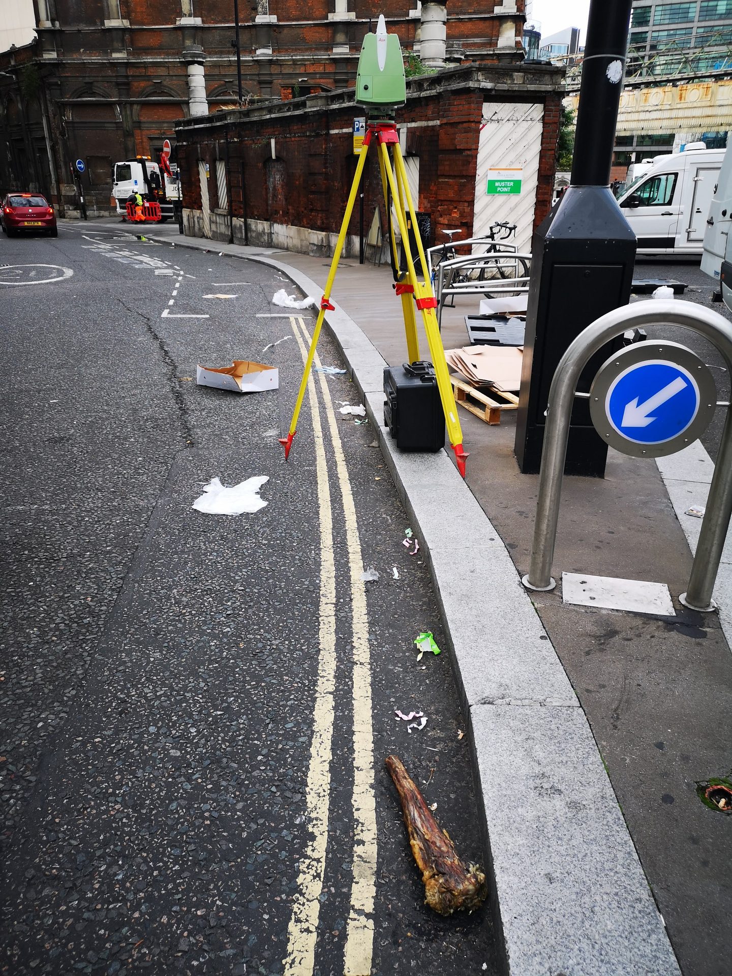
A terrestrial laser scanner set up on site in London.
How Cyclone turns scans into one model
Individual scans are joined together in Leica Cyclone, a step called registration. This is where accuracy is either protected or lost.
- Pre-alignment. The RTC360’s visual-inertial system tracks its own movement between setups, so scans arrive in Cyclone already roughly in place.
- Cloud-to-cloud and target registration. Cyclone matches the overlapping geometry between neighbouring scans, plus survey targets where we’ve placed them, and refines each link.
- Bundle adjustment. All the links are solved together, so small errors are spread out and minimised, not stacked up from one scan to the next.
- Quality reports. Cyclone reports the error and overlap for every link and for the whole bundle. We check these before anything moves on. Well-captured data means there are no weak links.
- Georeferencing. The registered cloud is tied to a coordinate system, either national grid (such as OSGB36) or a local site grid, using surveyed control.
- Cleaning and export. Noise, people and moving objects are removed, and the cloud is exported (E57, LAS or LSP files) for the next stage.
The result is a single, unified point cloud with a known, documented accuracy. That is the reference everything else has to fit.
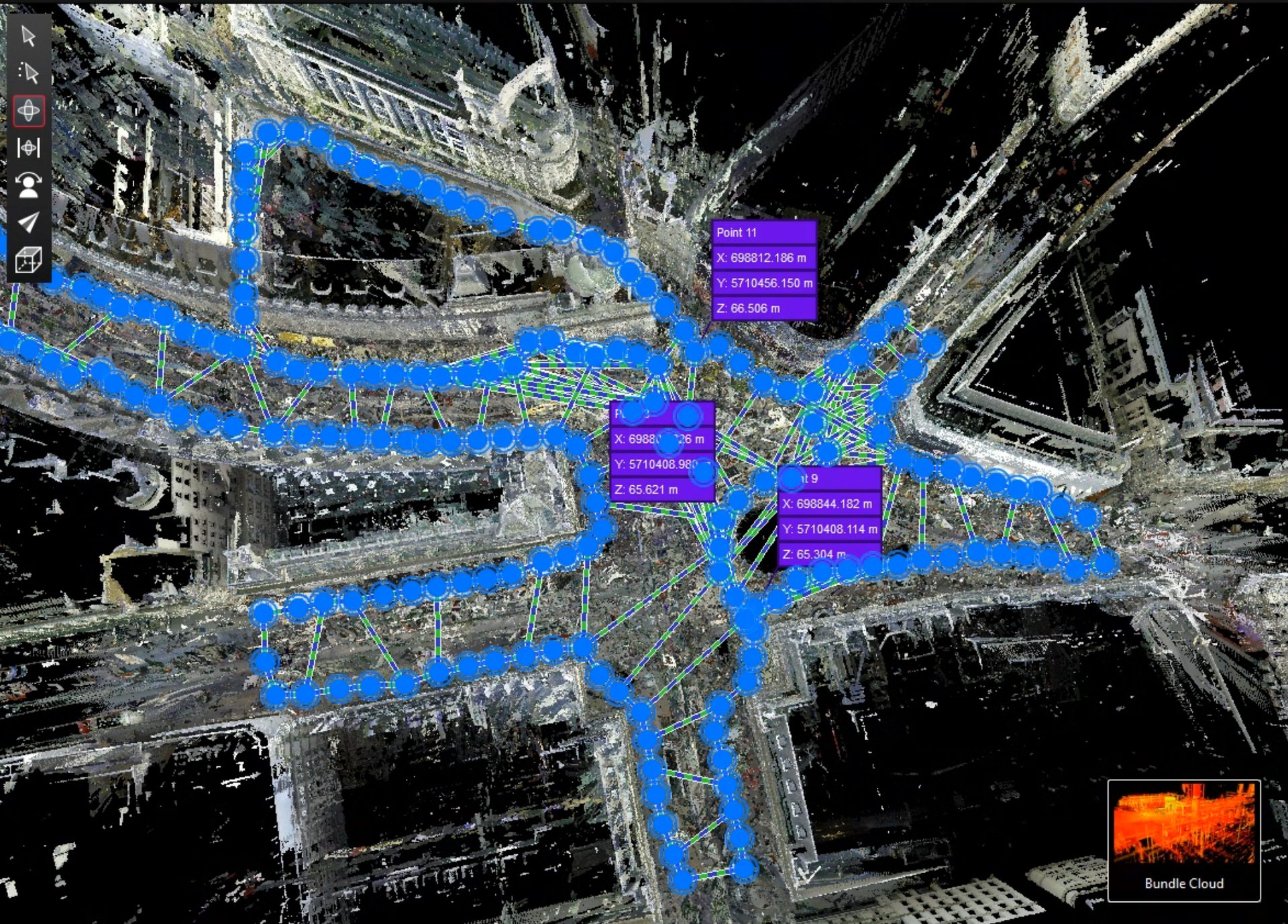
Registered scan network in Leica Cyclone, with surveyed control points.
Step two: RealityScan, where photogrammetry meets the LiDAR scan
LiDAR gives accurate geometry, but it doesn’t see everything. It also struggles to record fine colour, texture and the faces it can’t reach. Photogrammetry, from ground cameras and drones, fills those gaps. RealityScan is where we combine the two.
How RealityScan aligns images
RealityScan finds thousands of distinctive features in every photograph, such as corners, edges and patterns. It matches the same features across overlapping images. From those matches it works out where each camera was and which way it was pointing (its pose), along with the lens properties. Points seen in several images are triangulated into a sparse 3D cloud. Where enough images connect, they form a single “component” that shares one coordinate space.
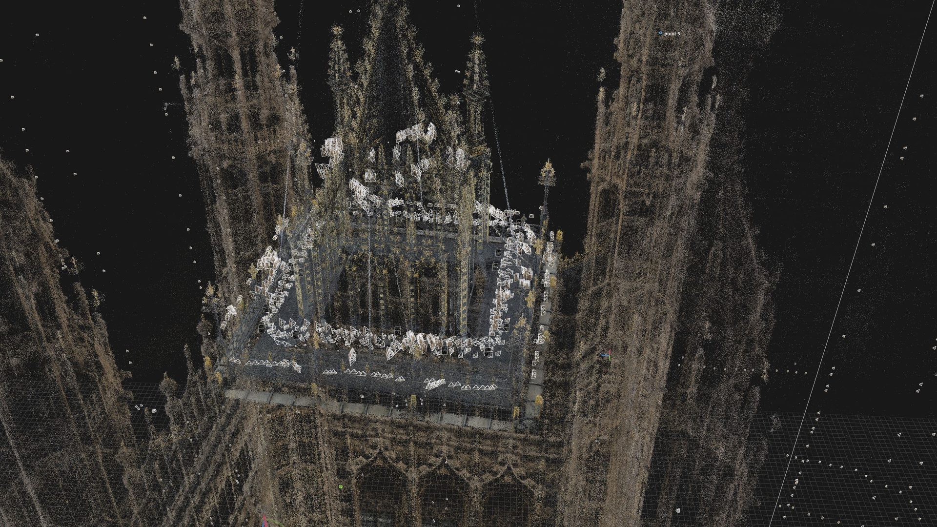
Photogrammetry camera positions aligned to the LiDAR point cloud of the Victoria Tower in RealityScan.
How the LiDAR and photogrammetry are merged
The registered laser scans are brought into RealityScan, and we lock their positions so it can’t move them. The images are then aligned to the scans, not the other way round. The LiDAR controls the scale and position, and the photography adds detail and colour on top.
Where RealityScan can’t find enough matches on its own, such as plain surfaces, repetitive patterns, crowds or poor light, we add control points by hand. These are the same physical feature marked in several images and in the scan, which pulls stray images into place. Ground control points from a survey can be added in the same way to fix the model to a coordinate system.
From aligned data to a digital double
Once everything sits in one component, RealityScan reconstructs a dense mesh, and the photographs are projected onto it as texture. The output can be a textured mesh, an orthographic elevation, a point cloud or a set of camera poses for another system to use.
Done properly, the result is a digital double: geometry measured to millimetres by the laser, and surfaces that look exactly like the real thing. Done carelessly (images forced into place, or scans allowed to drift), the model still looks convincing, but the measurements can’t be trusted. That is why the process matters.
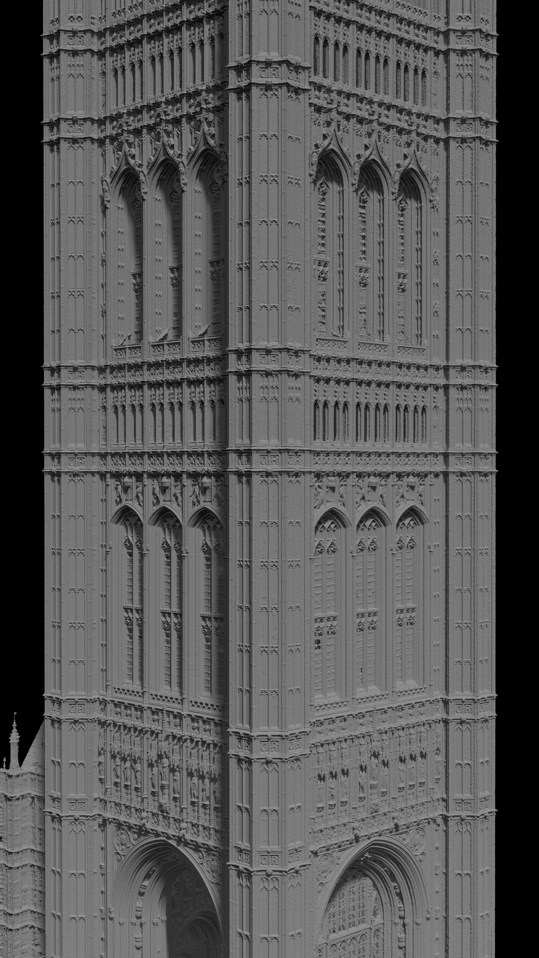
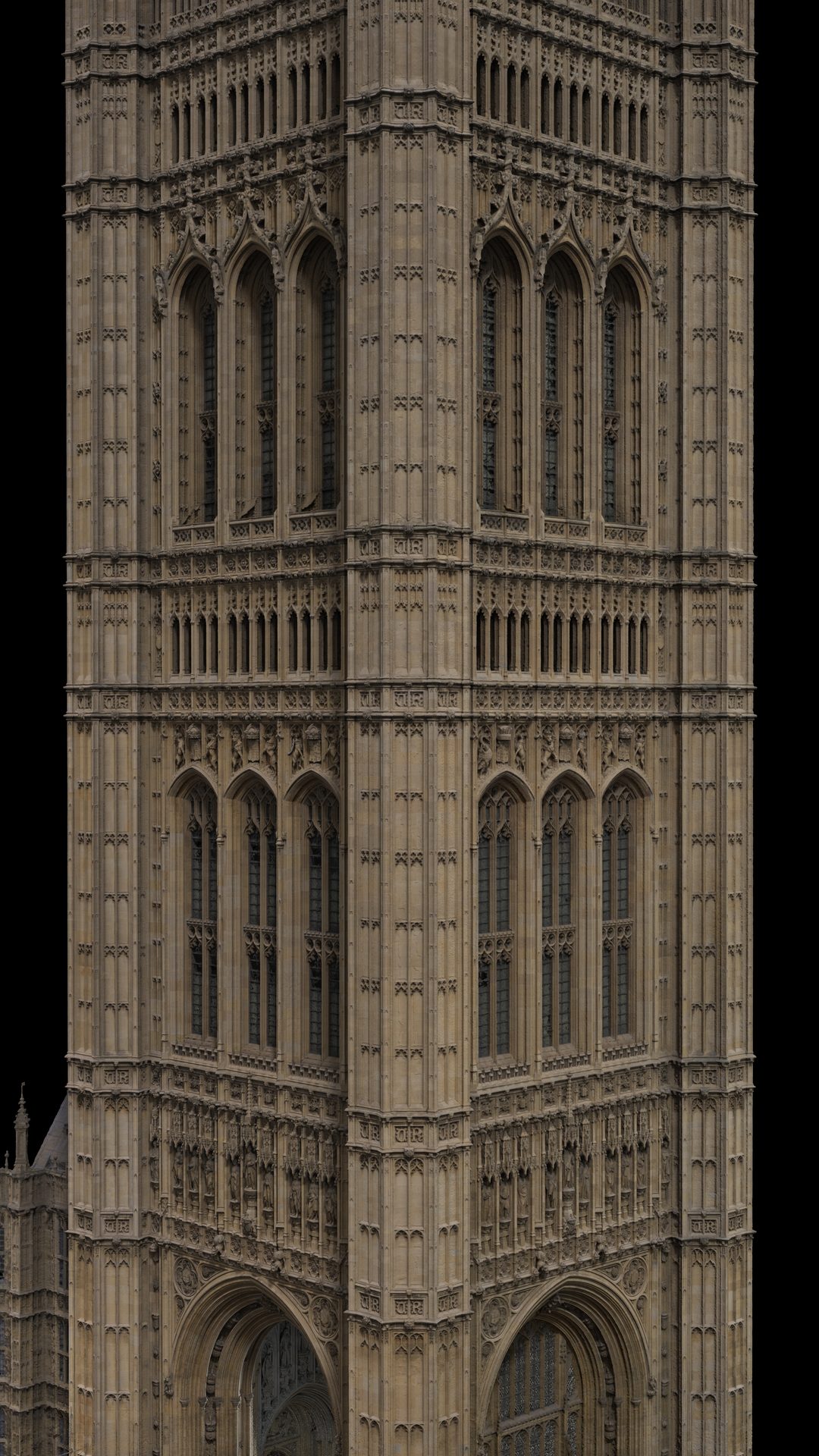
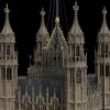
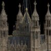
The same Victoria Tower model as untextured geometry and as a textured digital double.
Step three: checking the combined result
A model that looks right isn’t proof that it is right. Before anything is delivered, we check the combined LiDAR and image data in RealityScan against numbers, not just by eye.
- Reprojection error. RealityScan reports how far each triangulated point lands from where it was seen in each image, in pixels. Low mean and median error across the component means the images agree with each other and with the scans.
- Registration rate. We check how many images joined the main component and which didn’t. Unaligned images show where coverage is weak or where the data needs another look.
- Control point residuals. Every manual and surveyed control point shows how far the solved model sits from where it should be. Large residuals get investigated, not hidden.
- Model against cloud. We compare the finished mesh with the registered point cloud to make sure the photogrammetry hasn’t pulled the geometry away from the laser data.
- Independent checks. Where drawings or survey data exist, we check against them. On the Houses of Parliament, the Victoria Tower data lined up with the existing 2D plans.
These checks are what turn “it looks good” into “it’s accurate to a known tolerance”.
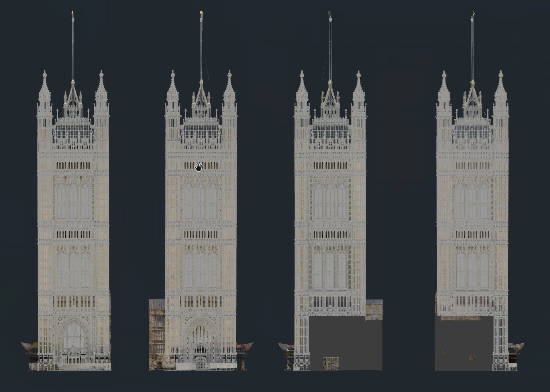
Orthographic elevations of the Victoria Tower, checked against the existing 2D plans.
The process in practice: four millimetre-accurate 3D scanning projects
Houses of Parliament: Victoria Tower heritage survey
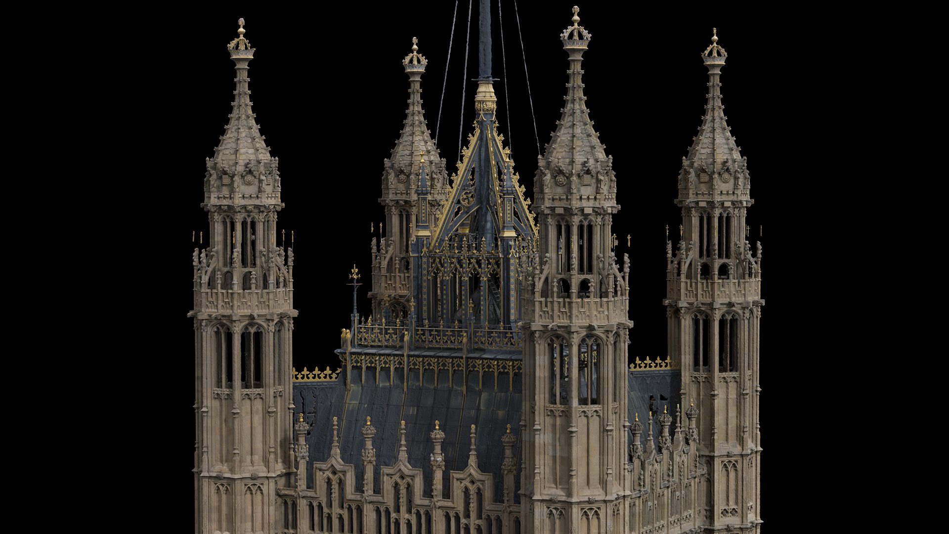
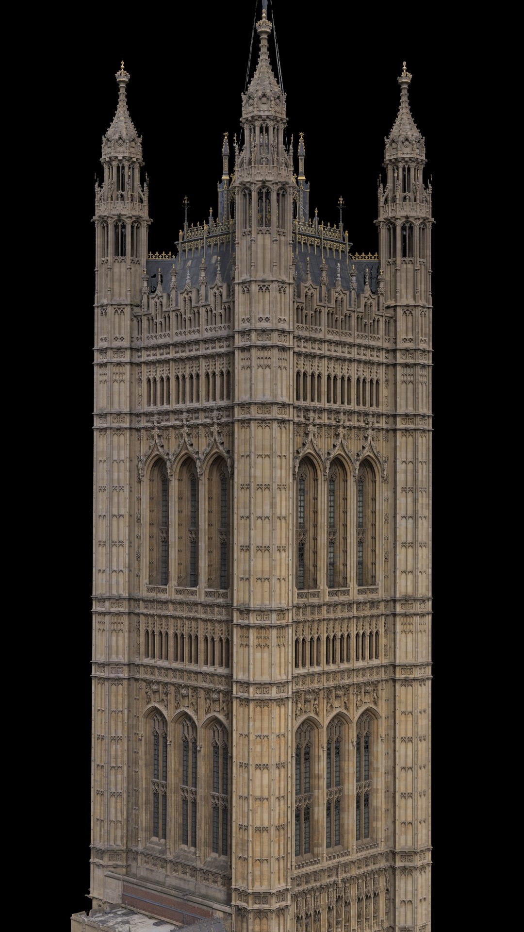
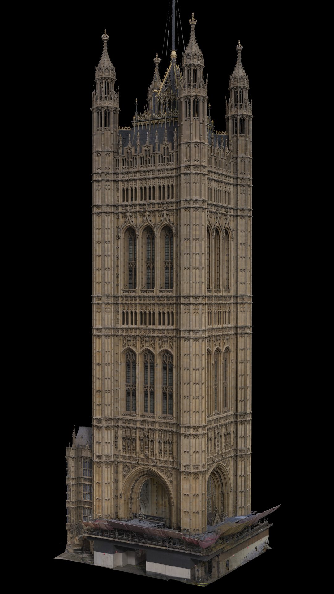
On the Parliamentary Estate we recorded the Victoria Tower, Portcullis House, the Norman Shaw South roof and the Sovereign’s Entrance between December 2022 and March 2023. Access was tightly controlled: roof work needed safety training and a chaperone, and only one crew member at a time could go up the tower.
We combined:
- Terrestrial LiDAR with the Leica RTC360 and P50, including scans from the top of the Victoria Tower
- Drone photogrammetry, flown with NATS approval
- Ground photography with 85 mm and 100 mm lenses, shooting flat-on and at 45 degrees to capture the detailed stonework
The aerial and terrestrial data were aligned in RealityScan and delivered on a local site grid as textured models and orthographic elevations. The Victoria Tower data lined up with the existing 2D plans. On a heritage building this complex, that agreement is what gives anyone working from the model confidence in it.
Niantic, Piccadilly Circus: local coordinates without losing true north
In July 2026 we scanned Piccadilly Circus in London for Niantic. Around 200 Leica RTC360 setups covered the circus and the streets leading off it, delivered as E57 point clouds with panoramic images from every setup.
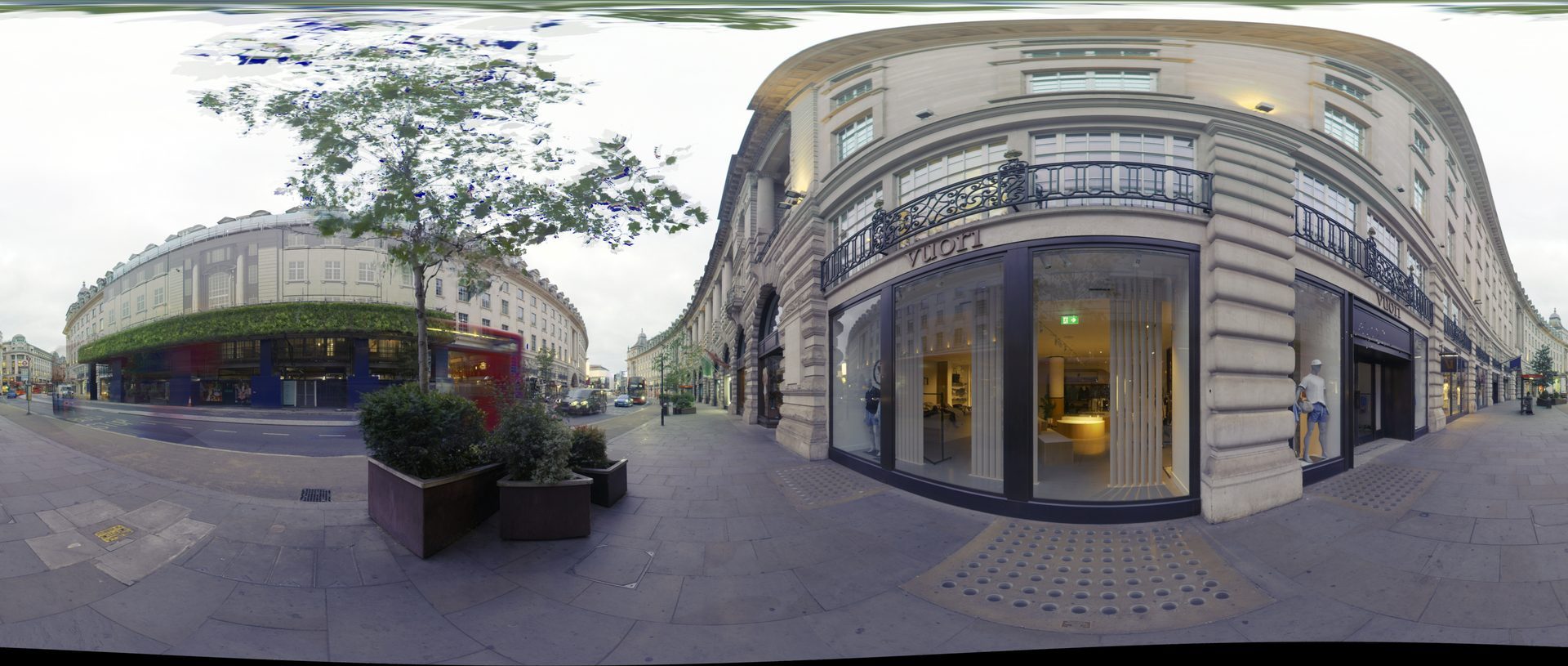
One of the panoramic images delivered with every scan setup.
Niantic needed the data in local coordinates, close to zero, with true north kept exact. That is harder than it sounds. A laser scanner levels itself precisely, but it doesn’t hold true north on its own, and Piccadilly Circus has no facades facing true north to orient against.
So we surveyed control markers with RTK GNSS and used them to georeference the whole registered dataset in Cyclone to ETRS89 / UTM zone 30N, with the control points sitting within about 1 cm. We then made one of the survey markers the origin and shifted every scan by that same offset. The rotation was never touched, so true north, scale and the registration between setups were all preserved exactly.
A small JSON file travels with the scans and records the offset and transformation, so the data can go back to the national grid at any time. Niantic got a dataset it could drop straight into its own system, with a documented route back to real-world coordinates.
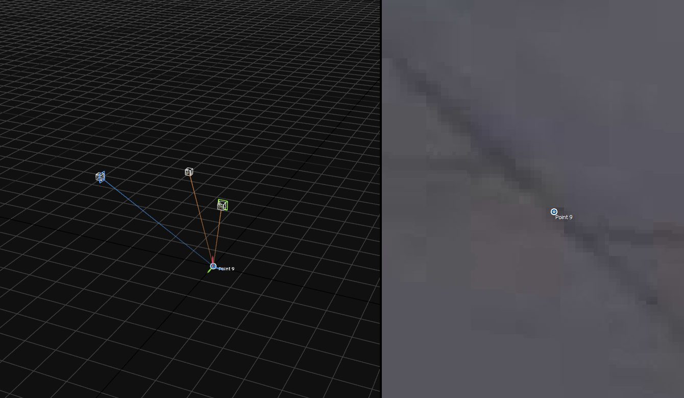
Survey point 9 set as the local origin, with the rotation left untouched.
Atlantic Airways helicopter: a digital twin from 20+ parts
For Atlantic Airways, we produced an interactive digital twin of one of its helicopters. We scanned it in its hangar in the Faroe Islands, both fully assembled and partly disassembled.
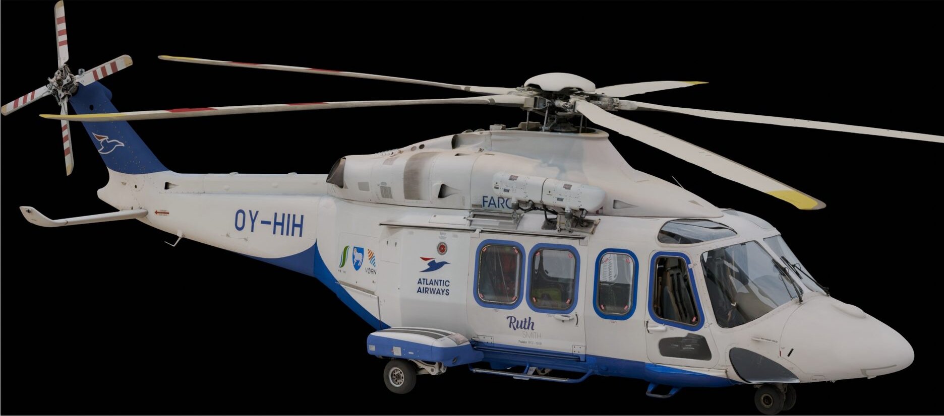
We combined:
- Terrestrial LiDAR for the overall airframe
- Photogrammetry for texture and detail
- An Artec Leo handheld scanner for tight interior spaces such as the tail compartment, fuel tanks and gearbox
Every Artec part was aligned to the LiDAR so all the components shared one scale and one coordinate space. That let us put more than 20 separately processed parts back together into a single model. The final interactive scene has clickable components, from the winch and doors to the nose instruments. Without a common, accurate reference, the parts simply wouldn’t have fitted.
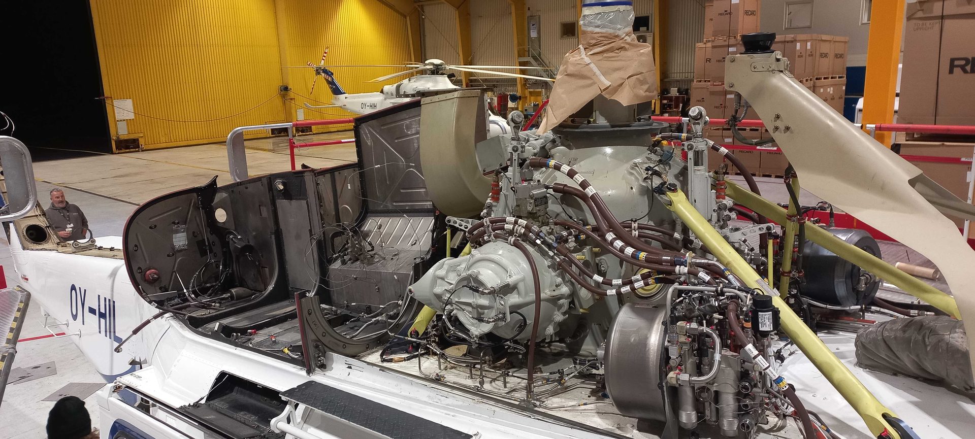
The helicopter partly disassembled in its hangar in the Faroe Islands.
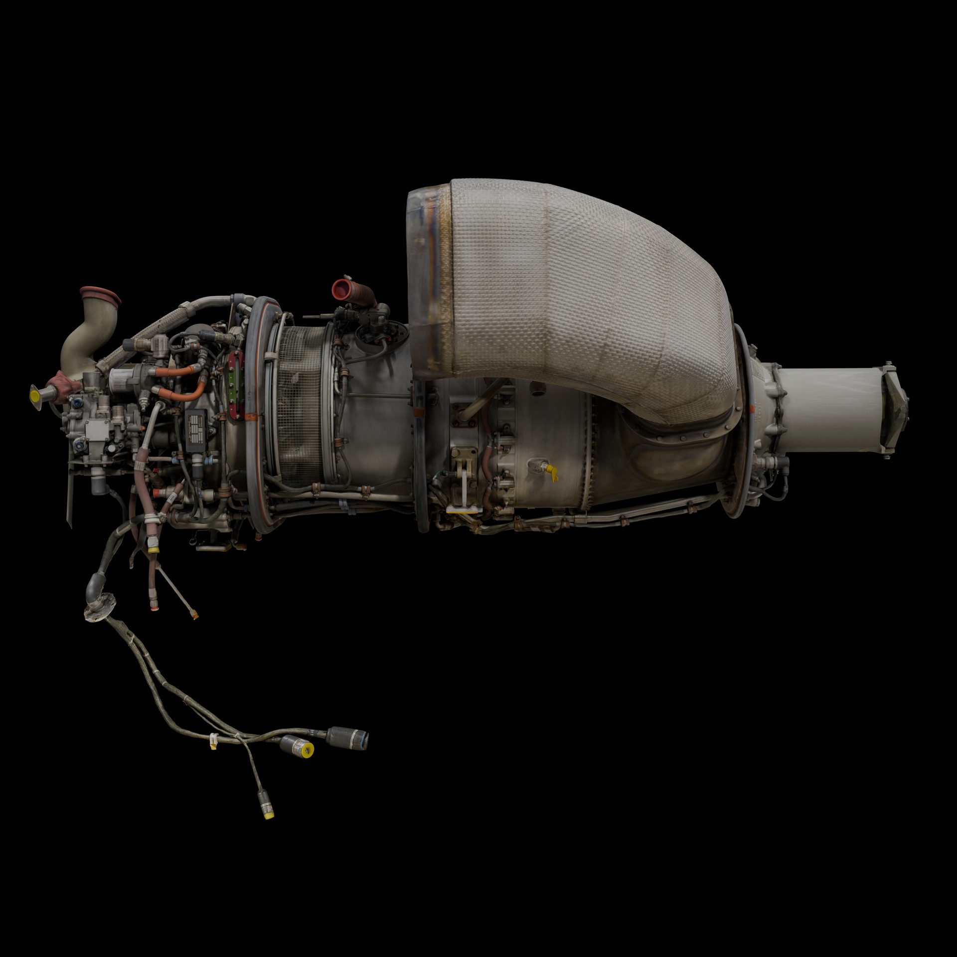
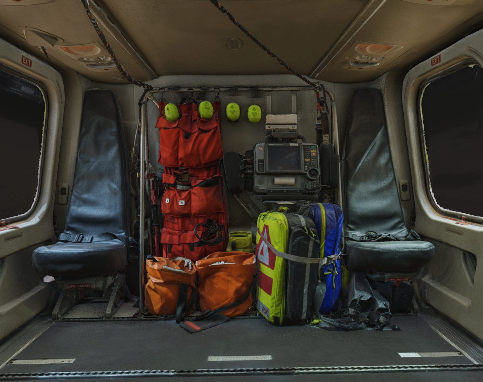
The scanned engine and cabin interior, aligned to the same LiDAR reference.
Smithfield Market: surveying the future London Museum
The General Market at West Smithfield, designed by Sir Horace Jones in 1883, is being turned into the new home of the London Museum. It opens on 28 November 2026. The building was derelict for years, and partial demolition of the interior exposed structural elements that had been hidden for decades.
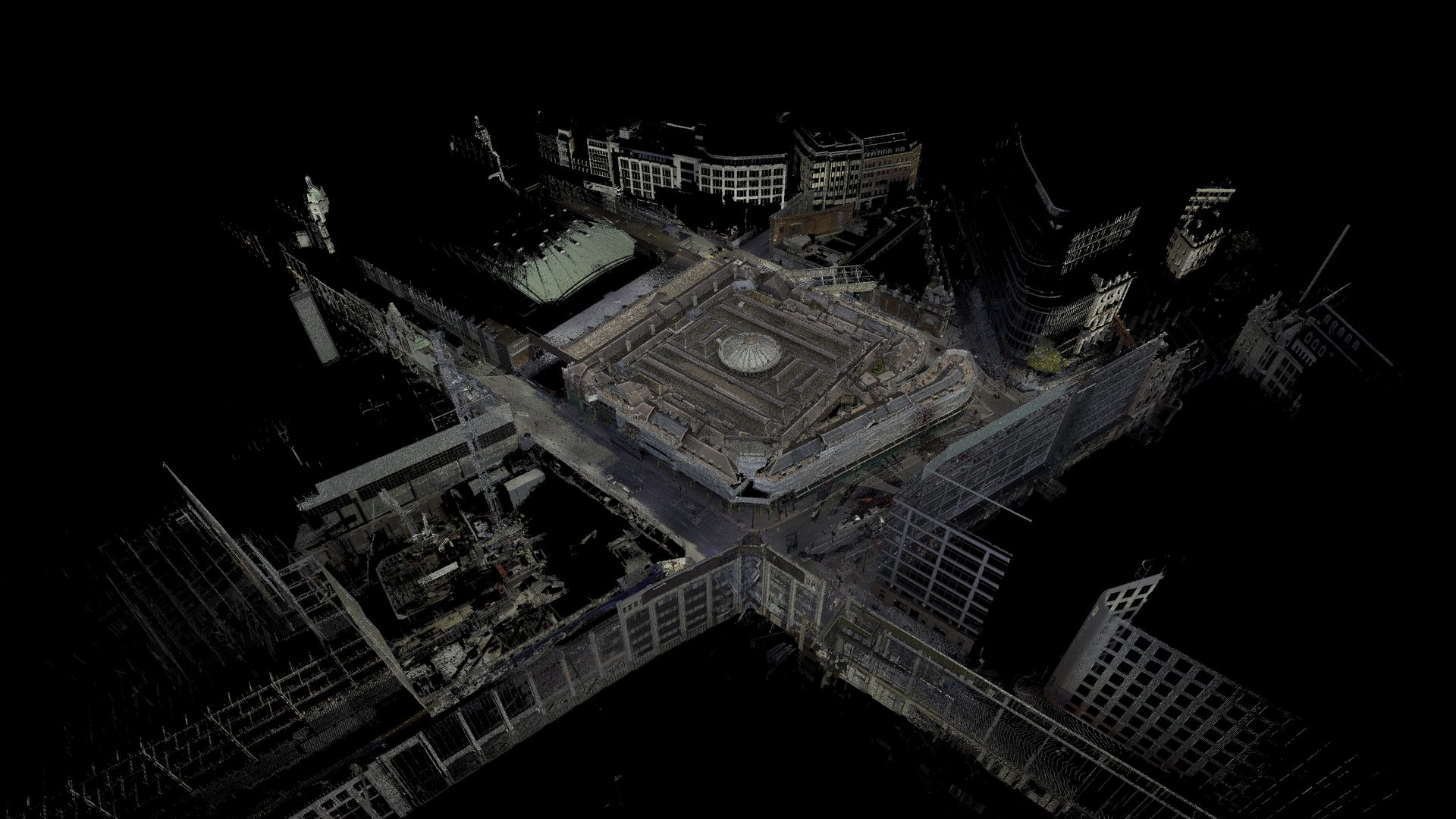
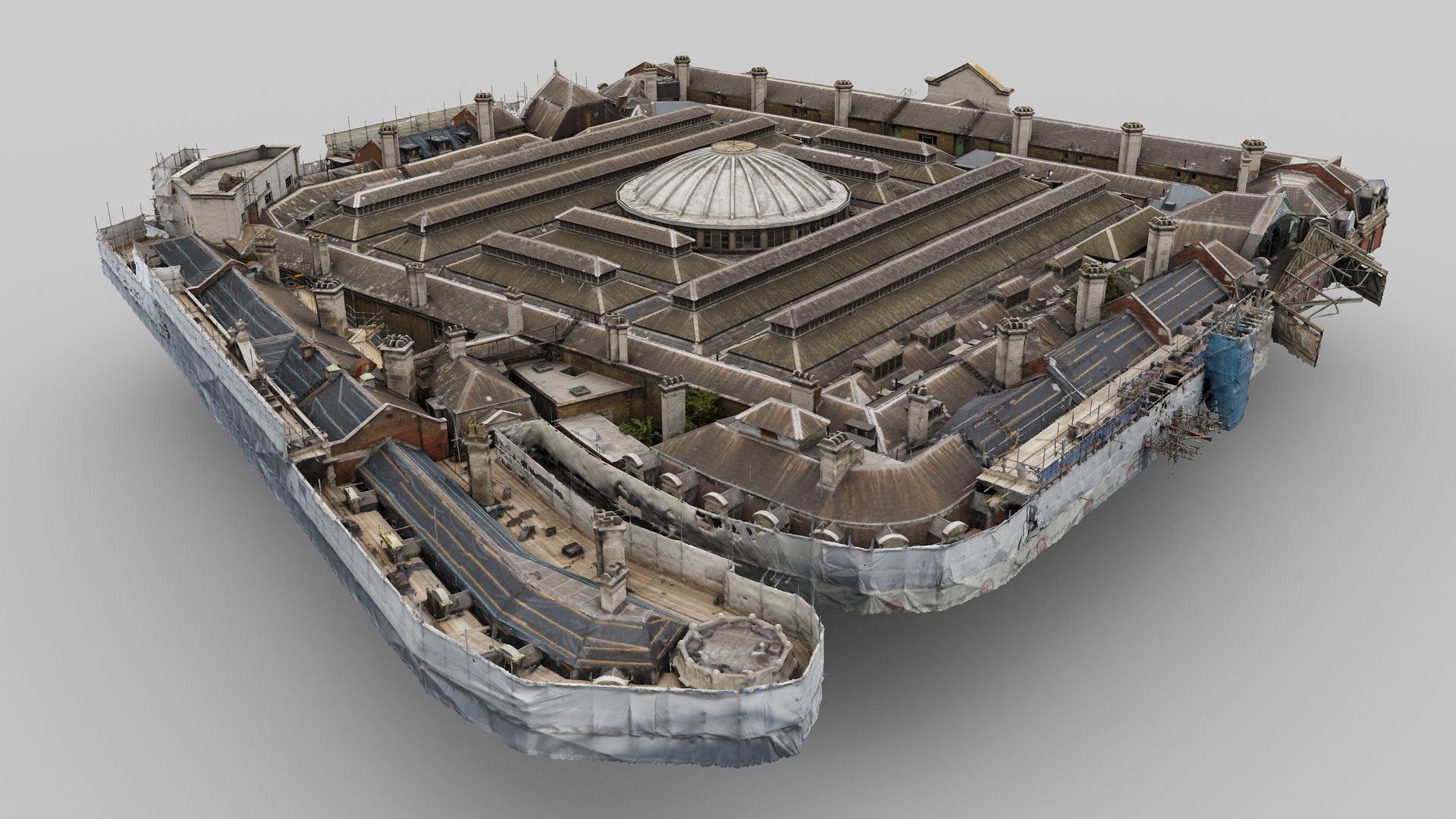
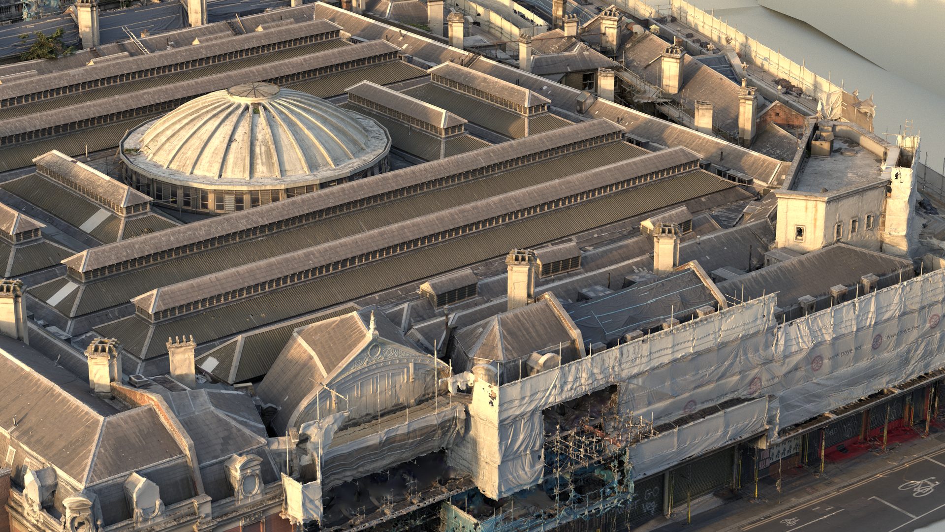
Working with Platinum 3D for their client BIM Technologies, we recorded the newly exposed structure and the complex roof. Parts of the roof were unsafe to access, so we combined terrestrial laser scanning with aerial photogrammetry. The drone reached what people couldn’t, and the LiDAR held the geometry to survey-grade accuracy.
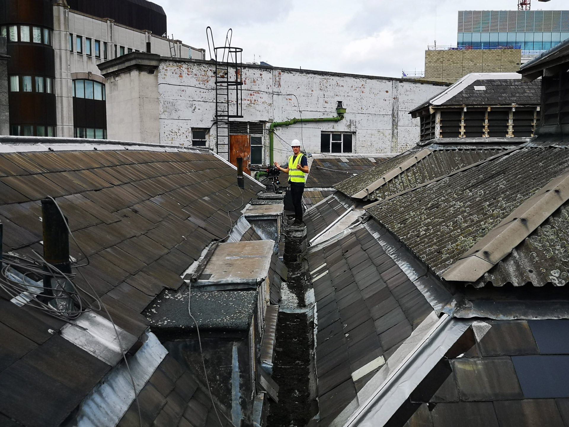
Recording the roof of the General Market at West Smithfield.
The resulting dataset serves as an interactive record of the building and a tool for dimensional checks, for the many stakeholders and consultants on the project. Read the full case study.
Why millimetre accuracy matters
Each of these projects depended on data that could be measured, not just viewed.
- The Parliament project needed models and elevations that matched the existing plans of a complex heritage site.
- Niantic needed local coordinates at Piccadilly Circus without losing true north.
- Atlantic Airways needed dozens of separately captured parts to fit back together exactly.
- The team at Smithfield needed to check dimensions on a fragile building they couldn’t fully reach.
Without millimetre accuracy, none of that work could go ahead. Designs wouldn’t fit, alignments would drift and decisions would rest on guesswork.
That accuracy doesn’t come from any single scanner or piece of software. It comes from following the process: measure with LiDAR, register and check in Cyclone, align and merge in RealityScan, and verify every step against the numbers. Trust the process, and the digital double you get back is one you can build on.
Have a project where accuracy matters?
Get in touch with the Visualskies team.