Digitising History at Smithfields
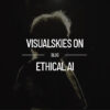
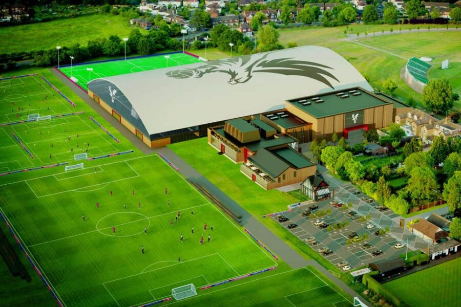
The General Market building in West Smithfield, owned by the City of London Corporation, is being repurposed as the new home of the Museum of London. The building has been derelict for a number of years and much is in a poor state of repair. Renovation works are underway and partial demolition of the building’s interior has exposed previously hidden structural components. Platinum 3D Consultant’s client BIM Technologies requested the provision of a comprehensive laser scan survey of the interior’s newly exposed structure and the complex roof structure. The purpose of the survey was to provide an interactive documentation tool and to facilitate dimensional verification for a range of stakeholders and consultants.
The project was complex due to the poor condition and fragility of parts of the building. Access was restricted on areas of the roof due to safety concerns. The best approach was deemed to be the combination of both Terrestrial Laser Scanning (TLS) and aerial photogrammetry to ensure even limited access areas could be recorded in detail. To this end Platinum 3D sought the experience of Visualskies who are experts in aerial data capture and processing. In partnership, we embarked on a combined effort to record this complex, historic building
The Brief
The objective was to create a georeferenced, uniformly spaced point cloud, with no occluded portions of the exterior roof structure and the ground floor interior. It was specified that the point cloud was to be delivered in a range of differing densities, or LODs, so that both more generalised and highly detailed 3D CAD data could be extracted by design teams. More significantly, the data also needed to be fully RGB textured.
Structural Degradation
During the Smithfield Project the team were faced with a number of surveying conundrums; mostly technological, but also, to a certain degree, physical. Multiple data capture techniques had to be used to collect the data whilst at the same time solving problems of access and visibility.
Parts of the roof have suffered from severe degradation due to water ingress, so no access was permitted in these areas. Terrestrial data capture techniques were not going to provide the full coverage that the brief specified without a significant risk of collapse or injury. Another challenge involved the integration of interior and exterior survey data into one correctly articulated whole. In some portions of the roof structure the inner and outer surfaces are a matter of only a few centimetres in thickness. Any fieldwork measurement errors would severely compromise the integrity and efficacy of the data to the client and contractors involved in the complex refurbishment and conservation of the nationally renowned building. It was essential that all the measurement techniques were undertaken using demonstrable and repeatable ‘best practice’ methodologies and equipment.
Methodology
Only by integrating the compatible vector and pixel data captured using TLS and aerial photogrammetry would it be possible to extract a complete 3D dataset of the whole market structure. It was possible to survey the interior of the market only using traditional TLS; but only by collecting data from the air could we accurately survey the whole of the roof exterior as the terrestrial LiDAR would only capture around 60 percent of the external structure. A number of the LiDAR scans were located at the periphery of the roof, and these created an overlapping dataset with the scans undertaken at pavement level.
The inaccessible and fragile nature of the historic roof structure necessitated the requirement for remote data capture. Visualskies have been utilising UAVs since 2015 to allow complete, safe and efficient surveying by combining information captured from the air with that collected from the ground. This tried and tested methodology presents a number of challenges when trying to operate a UAV within urban areas such as Smithfield, located in the centre of The City of London.
Tools of the Trade
Visualskies hold a special exemption from the CAA to operate not only small but also heavy lift UAVs (designed to carry heavy survey equipment) in congested areas. Fundamentally, this means that the statutory body for drone flights are satisfied that Visualskies risk mitigation measures and experience ensure they operate safely when in close proximity to people and structures such as at Smithfield. In addition to this, the airspace above the Market is a restricted zone meaning that any autonomous flight requires consent from both NATS (National Air Traffic Services) and the Parliamentary Diplomacy Protection Service, a process that traditionally requires a minimum of 21 days notice.
For Smithfield Visualskies selected the DJI M600 Pro drone, a hexacopter with multiple levels of redundancy, with the VSArray payload. Designed in-house this unique set-up can capture 10 times the area possible with terrestrial photography alone, and five times the area possible with standard aerial photogrammetry by utilising 5 GPS synchronised Sony cameras (Sony A7s and Sony RX100s) simultaneously capturing top down and oblique angles. This combination of redundancy and multi-directional high-resolution image data capture ensures minimal time in the air to aid in the reduction of risk.
”This is an example of how we at Visualskies are constantly assessing and refining our hardware, software and methodologies to stay at the cutting edge of collecting, processing, and presenting digital spatial data. We are the future of 3D/4D scanning technologies.